Earthquake Northern Sumatra, Indonesia
Mon, 09 Feb 2026 17:42:14 GMT
Time1 hour ago
Location
1.2615, 98.8540
Depth
61.9 KM
Event Summary
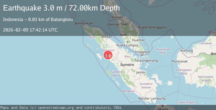
A 2.7 magnitude earthquake struck on Northern Sumatra, Indonesia, at Mon, 09 Feb 2026 17:42:14 GMT. Depth: 61.853882km. Reviewed by BMKG seismologists, this minor quake occurred at a magnitude type of M.
Magnitude
2.7
M
Source
BMKG
Intensity
-
Agency Reports
1 Sources| Source | Magnitude | Depth | Time |
|---|---|---|---|
| BMKGPrimary | 2.7 | 62 km | 1 hour ago |
Earthquake Details
AutomaticEvent IDbmg2026cupr
Tsunami PotentialNo
Magnitude TypeM
Nearest Places
- Rodang Bantot1.1 km
- Gle Batupeti2.2 km
- Batumundam3.3 km
- Gle Ranto Panjang3.4 km
- Rawa Maraitgadang3.5 km
Comments
Join the discussion about this event.
Latest Earthquakes
3.6Mag
Seram, Indonesia
Time1 hour ago
Depth8.46 km
SourceBMKG (Automatic)
2.0Mag
ISLAND OF HAWAII, HAWAII
Time1 hour ago
Depth4.30 km
SourceHV (Automatic)
0.7Mag
6 km NW of The Geysers, CA
Time1 hour ago
Depth3.21 km
SourceUSGS (Automatic)
2.7Mag
Timor Region
Time1 hour ago
Depth95.97 km
SourceBMKG (Automatic)
1.2Mag
EASTERN TURKEY
Time1 hour ago
Depth6.90 km
SourceAFAD (Automatic)
Nearby Earthquakes
2.8Mag
Northern Sumatra, Indonesia
Time1 day ago
Depth79.18 km
SourceBMKG (Automatic)
2.2Mag
Northern Sumatra, Indonesia
Time1 week ago
Depth99.84 km
SourceBMKG (Automatic)
2.6Mag
Northern Sumatra, Indonesia
Time2 weeks ago
Depth3.77 km
SourceBMKG (Automatic)
2.3Mag
Northern Sumatra, Indonesia
Time1 week ago
Depth35.32 km
SourceBMKG (Automatic)
2.4Mag
Northern Sumatra, Indonesia
Time2 weeks ago
Depth2.17 km
SourceBMKG (Automatic)