Earthquake Northern Sumatra, Indonesia
Mon, 09 Feb 2026 22:37:10 GMT
Time1 hour ago
Location
4.9523, 96.7494
Depth
3.7 KM
Event Summary
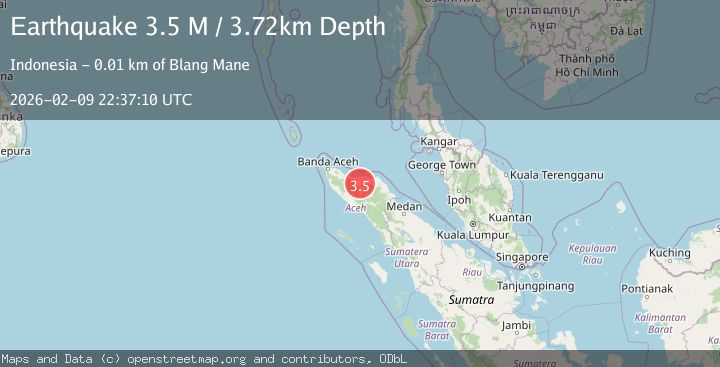
A 3.5 magnitude earthquake struck on Northern Sumatra, Indonesia, at Mon, 09 Feb 2026 22:37:10 GMT. Depth: 3.72461km. Reviewed by BMKG seismologists, this minor quake occurred at a magnitude type of M.
Magnitude
3.5
M
Source
BMKG
Intensity
-
Agency Reports
1 Sources| Source | Magnitude | Depth | Time |
|---|---|---|---|
| BMKGPrimary | 3.5 | 4 km | 1 hour ago |
Earthquake Details
AutomaticEvent IDbmg2026cuzk
Tsunami PotentialNo
Magnitude TypeM
Nearest Places
- Kilometer Empatpuluh4.0 km
- Gampong Ulu Naron4.2 km
- Gampong Negeri Antara4.5 km
- Kecamatan Pintu Rime Gayo4.7 km
- Blangrakal5.6 km
Comments
Join the discussion about this event.
Latest Earthquakes
1.9Mag
11 km SE of Pinnacles, CA
Time1 hour ago
Depth7.41 km
SourceUSGS (Automatic)
1.5Mag
21 km SSW of Manley Hot Springs, Alaska
Time1 hour ago
Depth12.80 km
SourceUSGS (Automatic)
2.2Mag
West Papua Region, Indonesia
Time1 hour ago
Depth146.08 km
SourceBMKG (Automatic)
2.0Mag
WESTERN TURKEY
Time1 hour ago
Depth5.20 km
SourceKOERI (Automatic)
1.7Mag
4 km S of Falls City, Texas
Time2 hours ago
Depth12.60 km
SourceUSGS (Automatic)
Nearby Earthquakes
4.1Mag
Northern Sumatra, Indonesia
Time1 week ago
Depth10.00 km
SourceBMKG (Automatic)
2.6Mag
Northern Sumatra, Indonesia
Time2 weeks ago
Depth10.00 km
SourceBMKG (Automatic)
2.5Mag
Northern Sumatra, Indonesia
Time1 week ago
Depth6.53 km
SourceBMKG (Automatic)
3.7Mag
Northern Sumatra, Indonesia
Time1 week ago
Depth5.47 km
SourceBMKG (Automatic)
2.5Mag
Northern Sumatra, Indonesia
Time1 week ago
Depth3.46 km
SourceBMKG (Automatic)