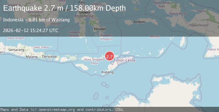
Earthquake Timor Region
Thu, 12 Feb 2026 15:24:27 GMT
Time1 week ago
Location
-8.4802, 124.4689
Depth
188.9 KM
Event Summary
A 2.7 magnitude earthquake struck on Timor Region, at Thu, 12 Feb 2026 15:24:27 GMT. Depth: 188.852676km. Reviewed by BMKG seismologists, this minor quake occurred at a magnitude type of M.
Magnitude
2.7
M
Source
BMKG
Intensity
-
Agency Reports
1 Sources| Source | Magnitude | Depth | Time |
|---|---|---|---|
| BMKGPrimary | 2.7 | 158 km | 1 week ago |
Earthquake Details
ManualEvent IDbmg2026czxq
Tsunami PotentialNo
Magnitude TypeM
Nearest Places
- Alu Ihirgahal4.5 km
- Alu Tamkudak4.5 km
- Mamatang4.6 km
- Batmi4.7 km
- Molelang4.7 km
Comments
Join the discussion about this event.
Latest Earthquakes
1.4Mag
8 km N of Rancho Cucamonga, CA
Time17 hours ago
Depth3.48 km
SourceUSGS (Automatic)
2.7Mag
COQUIMBO, CHILE
Time17 hours ago
Depth47.60 km
SourceCSN (Automatic)
1.3Mag
17 km WSW of Johannesburg, CA
Time17 hours ago
Depth9.21 km
SourceUSGS (Automatic)
1.4Mag
16 km ESE of Stanton, Texas
Time17 hours ago
Depth4.00 km
SourceUSGS (Automatic)
2.0Mag
Flores Region, Indonesia
Time17 hours ago
Depth27.22 km
SourceBMKG
Nearby Earthquakes
2.3Mag
Timor Region
Time4 days ago
Depth0.87 km
SourceBMKG
3.5Mag
Timor Region
Time1 week ago
Depth195.15 km
SourceBMKG (Automatic)
3.0Mag
KEPULAUAN ALOR, INDONESIA
Time3 years ago
Depth18.00 km
SourceDJA (Automatic)
2.1Mag
Timor Region
Time1 week ago
Depth94.29 km
SourceBMKG (Automatic)
3.4Mag
Timor region, Indonesia
Time1 week ago
Depth312.13 km
SourceVYT (Automatic)