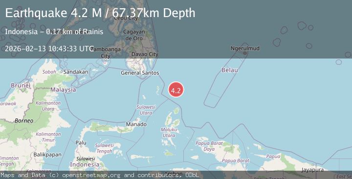
Earthquake North of Halmahera, Indonesia
Fri, 13 Feb 2026 10:43:33 GMT
Time5 days ago
Location
4.2220, 128.4162
Depth
67.4 KM
Event Summary
A 4.2 magnitude earthquake struck on North of Halmahera, Indonesia, at Fri, 13 Feb 2026 10:43:33 GMT. Depth: 67.373154km. Reviewed by BMKG seismologists, this light quake occurred at a magnitude type of M.
Magnitude
4.2
M
Source
BMKG
Intensity
-
Agency Reports
1 Sources| Source | Magnitude | Depth | Time |
|---|---|---|---|
| BMKGPrimary | 4.2 | 67 km | 5 days ago |
Earthquake Details
ManualEvent IDbmg2026dbjw
Tsunami PotentialNo
Magnitude TypeM
Nearest Places
- Snellius Ridge52.4 km
- Talaud Trough113.6 km
- Morotai Basin143.5 km
- Pulau Karis144.4 km
- Pulau Kakorotan146.4 km
Comments
Join the discussion about this event.
Latest Earthquakes
1.9Mag
Tarapaca, Chile
Time2 hours ago
Depth7.93 km
SourceVYT (Automatic)
2.4Mag
West Papua Region, Indonesia
Time2 hours ago
Depth7.47 km
SourceBMKG
2.7Mag
Antofagasta, Chile
Time2 hours ago
Depth0.00 km
SourceVYT (Automatic)
2.7Mag
Tarapaca, Chile
Time2 hours ago
Depth10.50 km
SourceVYT (Automatic)
2.7Mag
South of Java, Indonesia
Time3 hours ago
Depth24.46 km
SourceBMKG
Nearby Earthquakes
4.0Mag
North of Halmahera, Indonesia
Time4 days ago
Depth139.41 km
SourceBMKG
4.4Mag
North of Halmahera, Indonesia
Time4 days ago
Depth10.00 km
SourceBMKG
3.9Mag
North of Halmahera, Indonesia
Time4 days ago
Depth91.68 km
SourceBMKG
4.7Mag
North of Halmahera, Indonesia
Time5 days ago
Depth47.15 km
SourceBMKG
4.5Mag
North of Halmahera, Indonesia
Time4 days ago
Depth10.00 km
SourceBMKG