Earthquake SOUTHERN ALASKA
Sat, 24 Jan 2026 06:03:29 GMT
Time3 days ago
Location
61.2870, -152.2480
Depth
5.0 KM
Event Summary
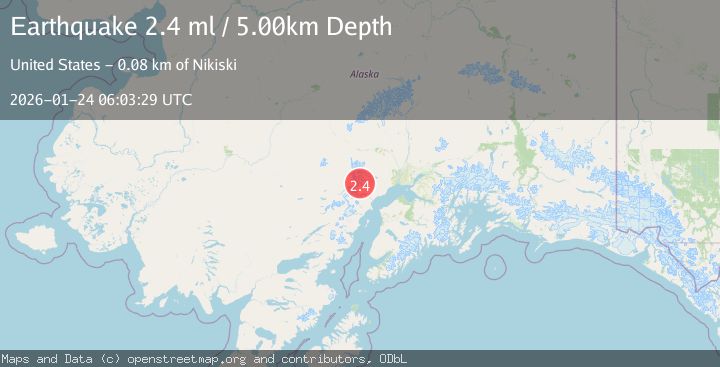
A 3.1 magnitude earthquake struck on SOUTHERN ALASKA, at Sat, 24 Jan 2026 06:03:29 GMT. Depth: 5km. Reviewed by AK seismologists, this minor quake occurred at a magnitude type of ml.
Magnitude
3.1
ml
Source
AK
Intensity
-
Agency Reports
2 Sources| Source | Magnitude | Depth | Time |
|---|---|---|---|
| AKPrimary | 3.1 | 5 km | 3 days ago |
| USGS | 2.4 | 5 km | 3 days ago |
Earthquake Details
AutomaticEvent IDemsc_AK_20260124_0000113
Tsunami PotentialNo
Magnitude Typeml
Nearest Places
- Mount Spurr1.4 km
- Crater Peak2.1 km
- Spurr Ice Plateau3.6 km
- The Rowel4.1 km
- Crater Glacier4.3 km
Comments
Join the discussion about this event.
Latest Earthquakes
2.3Mag
17 km E of Ferry, Alaska
Time2 minutes ago
Depth5.00 km
SourceUSGS (Automatic)
2.1Mag
West Papua Region, Indonesia
Time9 minutes ago
Depth10.00 km
SourceBMKG (Automatic)
4.0Mag
SAN JUAN, ARGENTINA
Time9 minutes ago
Depth123.70 km
SourceCSN (Automatic)
4.0Mag
BANDA SEA
Time11 minutes ago
Depth101.00 km
SourceBMKG (Automatic)
1.6Mag
1 km WSW of Pittsburg, CA
Time13 minutes ago
Depth15.89 km
SourceUSGS (Automatic)
Nearby Earthquakes
0.8Mag
57 km WNW of Tyonek, Alaska
Time4 days ago
Depth115.90 km
SourceUSGS (Automatic)
1.8Mag
66 km WNW of Tyonek, Alaska
Time3 days ago
Depth13.70 km
SourceUSGS (Automatic)
2.2Mag
56 km W of Tyonek, Alaska
Time4 days ago
Depth110.90 km
SourceUSGS (Automatic)
2.2Mag
60 km W of Tyonek, Alaska
Time4 days ago
Depth113.30 km
SourceUSGS (Automatic)
1.3Mag
67 km W of Tyonek, Alaska
Time5 days ago
Depth109.90 km
SourceUSGS (Automatic)