Earthquake CENTRAL ALASKA
Mon, 26 Jan 2026 07:01:50 GMT
Time1 day ago
Location
63.1980, -150.5930
Depth
134.5 KM
Event Summary
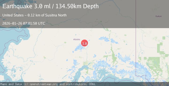
A 3.0 magnitude earthquake struck on CENTRAL ALASKA, at Mon, 26 Jan 2026 07:01:50 GMT. Depth: 134.5km. Reviewed by AK seismologists, this minor quake occurred at a magnitude type of ml.
Magnitude
3.0
ml
Source
AK
Intensity
-
Agency Reports
2 Sources| Source | Magnitude | Depth | Time |
|---|---|---|---|
| AKPrimary | 3.0 | 135 km | 1 day ago |
| USGS | 3.0 | 135 km | 1 day ago |
Earthquake Details
AutomaticEvent IDemsc_AK_20260126_0000115
Tsunami PotentialNo
Magnitude Typeml
Nearest Places
- Ragged Peak2.3 km
- Mount Brooks3.0 km
- Wedge Peak4.2 km
- Brooks Glacier4.8 km
- East Pyramid Peak4.9 km
Comments
Join the discussion about this event.
Latest Earthquakes
3.7Mag
Java, Indonesia
Time10 minutes ago
Depth26.88 km
SourceBMKG (Automatic)
1.7Mag
20 km ENE of Arvin, CA
Time11 minutes ago
Depth5.64 km
SourceUSGS (Automatic)
2.3Mag
57 km E of Pedro Bay, Alaska
Time16 minutes ago
Depth120.40 km
SourceUSGS (Automatic)
2.3Mag
Bali Sea
Time18 minutes ago
Depth13.31 km
SourceBMKG (Automatic)
1.9Mag
97 km S of Kokhanok, Alaska
Time22 minutes ago
Depth5.00 km
SourceUSGS (Automatic)
Nearby Earthquakes
1.4Mag
69 km SE of Denali National Park, Alaska
Time3 days ago
Depth119.50 km
SourceUSGS (Automatic)
1.6Mag
71 km WSW of Cantwell, Alaska
Time1 day ago
Depth98.90 km
SourceUSGS (Automatic)
2.3Mag
63 km SE of Denali National Park, Alaska
Time1 day ago
Depth127.50 km
SourceUSGS (Automatic)
1.3Mag
38 km SE of Denali National Park, Alaska
Time4 days ago
Depth6.90 km
SourceUSGS (Automatic)
1.2Mag
37 km SE of Denali National Park, Alaska
Time5 days ago
Depth5.00 km
SourceUSGS (Automatic)