Earthquake 96 km N of Yakutat, Alaska
Thu, 29 Jan 2026 18:37:57 GMT
Time7 hours ago
Location
60.4010, -139.4720
Depth
5.0 KM
Event Summary
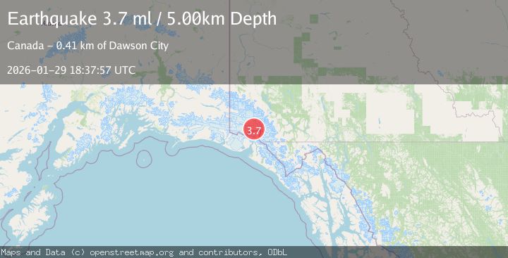
A 3.7 magnitude earthquake struck on 96 km N of Yakutat, Alaska, at Thu, 29 Jan 2026 18:37:57 GMT. Depth: 5km. Reviewed by USGS seismologists, this minor quake occurred at a magnitude type of ml.
Magnitude
3.7
ml
Source
USGS
Intensity
-
Agency Reports
1 Sources| Source | Magnitude | Depth | Time |
|---|---|---|---|
| USGSPrimary | 3.7 | 5 km | 7 hours ago |
Earthquake Details
ConfirmedEvent IDusgs_ak2026cavjzo
Tsunami PotentialNo
Magnitude Typeml
Nearest Places
- Hubbard Glacier8.2 km
- Hubbard Glacier11.2 km
- Mount Vancouver13.3 km
- St. Elias Mountains16.5 km
- Icefield Ranges18.7 km
Comments
Join the discussion about this event.
Latest Earthquakes
2.5Mag
Java, Indonesia
Time7 hours ago
Depth36.94 km
SourceBMKG (Automatic)
3.7Mag
SOUTHERN YUKON TERRITORY, CANADA
Time7 hours ago
Depth5.00 km
SourceAK (Automatic)
1.9Mag
14 km E of Pinnacles, CA
Time7 hours ago
Depth6.05 km
SourceUSGS (Automatic)
2.6Mag
WESTERN TEXAS
Time7 hours ago
Depth5.90 km
SourceTX (Automatic)
2.8Mag
West Papua Region, Indonesia
Time8 hours ago
Depth19.31 km
SourceBMKG (Automatic)
Nearby Earthquakes
3.7Mag
SOUTHERN YUKON TERRITORY, CANADA
Time7 hours ago
Depth5.00 km
SourceAK (Automatic)
3.5Mag
SOUTHERN YUKON TERRITORY, CANADA
Time23 hours ago
Depth5.00 km
SourceNEIC (Automatic)
2.5Mag
SOUTHERN YUKON TERRITORY, CANADA
Time3 days ago
Depth5.90 km
SourceNEIC (Automatic)
1.8Mag
107 km N of Yakutat, Alaska
Time2 days ago
Depth10.50 km
SourceUSGS
4.4Mag
SOUTHERN YUKON TERRITORY, CANADA
Time4 days ago
Depth5.00 km
SourceAK (Automatic)