Earthquake SUMBAWA REGION, INDONESIA
Mon, 05 Jan 2026 03:42:06 GMT
Time1 month ago
Location
-9.5400, 117.9500
Depth
23.0 KM
Event Summary
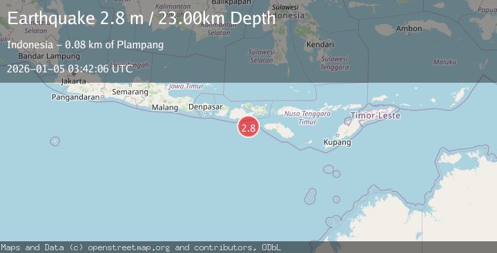
A 2.8 magnitude earthquake struck on SUMBAWA REGION, INDONESIA, at Mon, 05 Jan 2026 03:42:06 GMT. Depth: 23km. Reviewed by BMKG seismologists, this minor quake occurred at a magnitude type of m.
Magnitude
2.8
m
Source
BMKG
Intensity
-
Agency Reports
1 Sources| Source | Magnitude | Depth | Time |
|---|---|---|---|
| BMKGPrimary | 2.8 | 23 km | 1 month ago |
Earthquake Details
AutomaticEvent IDemsc_BMKG_20260105_0000051
Tsunami PotentialNo
Magnitude Typem
Nearest Places
- Tanjung Mata66.4 km
- Kokar Aipanam67.6 km
- Teluk Jongrusak67.7 km
- Brang Aimumit67.8 km
- Teluk Baru68.1 km
Comments
Join the discussion about this event.
Latest Earthquakes
1.9Mag
Southern Alaska
Time21 hours ago
Depth20.39 km
SourceVYT (Automatic)
2.1Mag
Flores region, Indonesia
Time21 hours ago
Depth26.61 km
SourceVYT (Automatic)
2.5Mag
Sulawesi, Indonesia
Time21 hours ago
Depth5.73 km
SourceBMKG
1.7Mag
5 km S of Calistoga, CA
Time21 hours ago
Depth8.81 km
SourceUSGS (Automatic)
2.1Mag
Sumbawa Region, Indonesia
Time21 hours ago
Depth26.24 km
SourceBMKG
Nearby Earthquakes
2.1Mag
Sumbawa Region, Indonesia
Time21 hours ago
Depth26.24 km
SourceBMKG
3.0Mag
SUMBAWA REGION, INDONESIA
Time5 months ago
Depth25.00 km
SourceBMKG (Automatic)
2.9Mag
SUMBAWA REGION, INDONESIA
Time1 month ago
Depth24.00 km
SourceBMKG (Automatic)
3.7Mag
SUMBAWA REGION, INDONESIA
Time1 month ago
Depth26.00 km
SourceBMKG (Automatic)
3.0Mag
Sumbawa Region, Indonesia
Time3 weeks ago
Depth51.24 km
SourceBMKG (Automatic)