Earthquake MAKASSAR STRAIT, INDONESIA
Wed, 14 Jan 2026 12:09:16 GMT
Time1 month ago
Location
1.6600, 119.7900
Depth
4.0 KM
Event Summary
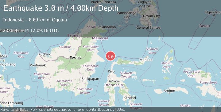
A 3.0 magnitude earthquake struck on MAKASSAR STRAIT, INDONESIA, at Wed, 14 Jan 2026 12:09:16 GMT. Depth: 4km. Reviewed by BMKG seismologists, this minor quake occurred at a magnitude type of m.
Magnitude
3.0
m
Source
BMKG
Intensity
-
Agency Reports
1 Sources| Source | Magnitude | Depth | Time |
|---|---|---|---|
| BMKGPrimary | 3.0 | 4 km | 1 month ago |
Earthquake Details
AutomaticEvent IDemsc_BMKG_20260114_0000146
Tsunami PotentialNo
Magnitude Typem
Nearest Places
- Pulau Sambit84.8 km
- Pulau Sambit Lighthouse84.9 km
- Pulau Balambangan88.9 km
- Pulau Lingayan90.8 km
- Lingayan91.0 km
Comments
Join the discussion about this event.
Latest Earthquakes
1.9Mag
British Columbia, Canada
Time1 minute ago
Depth0.00 km
SourceVYT (Automatic)
0.7Mag
84 km S of McCarthy, Alaska
Time3 minutes ago
Depth11.40 km
SourceUSGS (Automatic)
2.9Mag
Salta, Argentina
Time4 minutes ago
Depth255.49 km
SourceVYT (Automatic)
1.3Mag
4 km WSW of Calimesa, CA
Time4 minutes ago
Depth15.00 km
SourceUSGS (Automatic)
2.3Mag
Sumba Region, Indonesia
Time8 minutes ago
Depth7.66 km
SourceBMKG
Nearby Earthquakes
4.0Mag
MAKASSAR STRAIT, INDONESIA
Time4 years ago
Depth10.00 km
SourceDJA (Automatic)
5.4Mag
MINAHASA, SULAWESI, INDONESIA
Time2 years ago
Depth15.00 km
SourceEMSC (Automatic)
3.0Mag
MINAHASA, SULAWESI, INDONESIA
Time3 years ago
Depth10.00 km
SourceDJA (Automatic)
3.0Mag
MINAHASA, SULAWESI, INDONESIA
Time2 years ago
Depth10.00 km
SourceBMKG (Automatic)
5.1Mag
MAKASSAR STRAIT, INDONESIA
Time7 years ago
Depth30.00 km
SourceEMSC (Automatic)