Earthquake MAKASSAR STRAIT, INDONESIA
Sat, 04 Sep 2021 12:23:17 GMT
Time4 years ago
Location
1.4800, 119.7700
Depth
10.0 KM
Event Summary
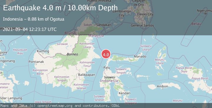
A 4.0 magnitude earthquake struck on MAKASSAR STRAIT, INDONESIA, at Sat, 04 Sep 2021 12:23:17 GMT. Depth: 10km. Reviewed by DJA seismologists, this light quake occurred at a magnitude type of m.
Magnitude
4.0
m
Source
DJA
Intensity
-
Agency Reports
1 Sources| Source | Magnitude | Depth | Time |
|---|---|---|---|
| DJAPrimary | 4.0 | 10 km | 4 years ago |
Earthquake Details
AutomaticEvent IDemsc_DJA_20210904_0000104
Tsunami PotentialNo
Magnitude Typem
Nearest Places
- Pulau Lingayan76.4 km
- Lingayan76.6 km
- Pulau Koko77.6 km
- Tanjung Aga78.7 km
- Tando Agisolo79.1 km
Comments
Join the discussion about this event.
Latest Earthquakes
2.2Mag
PORTUGAL
Time7 minutes ago
Depth12.00 km
SourceIPMA (Automatic)
4.2Mag
Fox Islands, Aleutian Islands, Alaska
Time7 minutes ago
Depth0.00 km
SourceVYT (Automatic)
1.8Mag
Sweden
Time8 minutes ago
Depth0.00 km
SourceVYT (Automatic)
2.0Mag
Bali Region, Indonesia
Time8 minutes ago
Depth73.97 km
SourceBMKG
2.5Mag
Java, Indonesia
Time9 minutes ago
Depth38.78 km
SourceBMKG
Nearby Earthquakes
3.0Mag
MAKASSAR STRAIT, INDONESIA
Time1 month ago
Depth4.00 km
SourceBMKG (Automatic)
3.0Mag
MINAHASA, SULAWESI, INDONESIA
Time3 years ago
Depth10.00 km
SourceDJA (Automatic)
4.0Mag
MAKASSAR STRAIT, INDONESIA
Time3 years ago
Depth10.00 km
SourceDJA (Automatic)
5.1Mag
MAKASSAR STRAIT, INDONESIA
Time7 years ago
Depth30.00 km
SourceEMSC (Automatic)
3.0Mag
MAKASSAR STRAIT, INDONESIA
Time2 years ago
Depth10.00 km
SourceBMKG (Automatic)