Earthquake BALI SEA
Fri, 16 Aug 2013 11:52:18 GMT
Time12 years ago
Location
-7.7800, 117.2100
Depth
300.0 KM
Event Summary
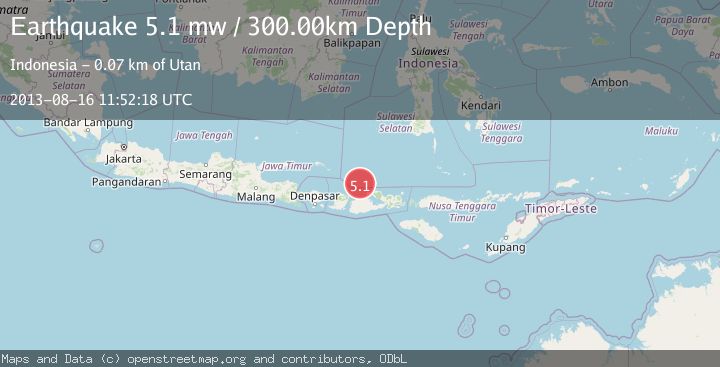
A 5.1 magnitude earthquake struck on BALI SEA, at Fri, 16 Aug 2013 11:52:18 GMT. Depth: 300km. Reviewed by EMSC seismologists, this moderate quake occurred at a magnitude type of mw.
Magnitude
5.1
mw
Source
EMSC
Intensity
-
Agency Reports
1 Sources| Source | Magnitude | Depth | Time |
|---|---|---|---|
| EMSCPrimary | 5.1 | 300 km | 12 years ago |
Earthquake Details
AutomaticEvent IDemsc_EMSC_20130816_0000062
Tsunami PotentialNo
Magnitude Typemw
Nearest Places
- Pulau Sadapur1.0 km
- Gosong Sakunci8.0 km
- Gosong Sadapur9.3 km
- Karang Satengar21.6 km
- Desa Satanger29.3 km
Comments
Join the discussion about this event.
Latest Earthquakes
2.2Mag
Flores Region, Indonesia
Time14 hours ago
Depth28.78 km
SourceBMKG
1.8Mag
Antofagasta, Chile
Time14 hours ago
Depth32.10 km
SourceVYT (Automatic)
1.4Mag
FRANCE
Time14 hours ago
Depth2.40 km
SourceETHZ (Automatic)
2.4Mag
Minahassa Peninsula, Sulawesi
Time14 hours ago
Depth7.56 km
SourceBMKG
2.7Mag
Halmahera, Indonesia
Time14 hours ago
Depth58.00 km
SourceBMKG