Earthquake NEAR N COAST OF PAPUA, INDONESIA
Thu, 26 Apr 2018 16:56:00 GMT
Time7 years ago
Location
-1.8400, 139.8000
Depth
20.0 KM
Event Summary
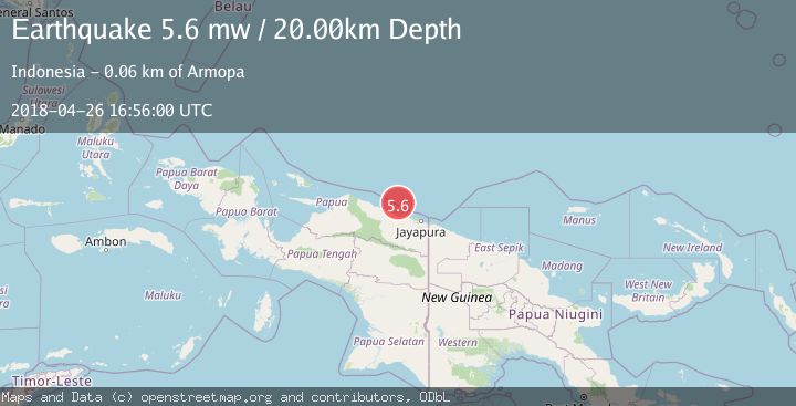
A 5.6 magnitude earthquake struck on NEAR N COAST OF PAPUA, INDONESIA, at Thu, 26 Apr 2018 16:56:00 GMT. Depth: 20km. Reviewed by EMSC seismologists, this moderate quake occurred at a magnitude type of mw.
Magnitude
5.6
mw
Source
EMSC
Intensity
-
Agency Reports
1 Sources| Source | Magnitude | Depth | Time |
|---|---|---|---|
| EMSCPrimary | 5.6 | 20 km | 7 years ago |
Earthquake Details
AutomaticEvent IDemsc_EMSC_20180426_0000089
Tsunami PotentialNo
Magnitude Typemw
Nearest Places
- Pulau Anus45.7 km
- Pulau Yarsun47.6 km
- Kepulauan Podena48.0 km
- Pulau Mengge48.4 km
- Pulau Kaitjebo48.5 km
Comments
Join the discussion about this event.
Latest Earthquakes
3.8Mag
Tarapaca, Chile
Time3 minutes ago
Depth93.51 km
SourceVYT (Automatic)
2.5Mag
Ceram Sea
Time5 minutes ago
Depth3.27 km
SourceBMKG
2.1Mag
Halmahera, Indonesia
Time8 minutes ago
Depth4.45 km
SourceBMKG
3.4Mag
Talaud Islands, Indonesia
Time11 minutes ago
Depth98.99 km
SourceBMKG
2.1Mag
Flores Region, Indonesia
Time12 minutes ago
Depth165.90 km
SourceBMKG
Nearby Earthquakes
3.3Mag
NEAR N COAST OF PAPUA, INDONESIA
Time1 week ago
Depth6.00 km
SourceBMKG (Automatic)
3.0Mag
NEAR N COAST OF PAPUA, INDONESIA
Time1 month ago
Depth13.00 km
SourceBMKG (Automatic)
2.4Mag
Near North Coast of West Papua
Time1 week ago
Depth10.00 km
SourceBMKG
2.5Mag
Near North Coast of West Papua
Time3 weeks ago
Depth10.00 km
SourceBMKG (Automatic)
2.8Mag
NEAR N COAST OF PAPUA, INDONESIA
Time1 month ago
Depth10.00 km
SourceBMKG (Automatic)