Earthquake MYANMAR-INDIA BORDER REGION
Sun, 21 Jun 2020 22:40:52 GMT
Time5 years ago
Location
23.1800, 93.3500
Depth
10.0 KM
Event Summary
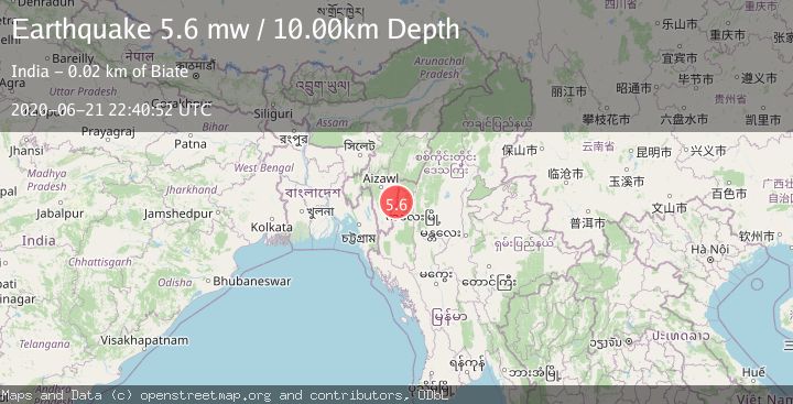
A 5.6 magnitude earthquake struck on MYANMAR-INDIA BORDER REGION, at Sun, 21 Jun 2020 22:40:52 GMT. Depth: 10km. Reviewed by EMSC seismologists, this moderate quake occurred at a magnitude type of mw.
Magnitude
5.6
mw
Source
EMSC
Intensity
-
Agency Reports
1 Sources| Source | Magnitude | Depth | Time |
|---|---|---|---|
| EMSCPrimary | 5.6 | 10 km | 5 years ago |
Earthquake Details
AutomaticEvent IDemsc_EMSC_20200621_0000218
Tsunami PotentialNo
Magnitude Typemw
Nearest Places
Comments
Join the discussion about this event.
Latest Earthquakes
2.2Mag
Southern Alaska
Time2 minutes ago
Depth4.64 km
SourceVYT (Automatic)
1.4Mag
50 km WNW of Tatitlek, Alaska
Time7 minutes ago
Depth35.10 km
SourceUSGS (Automatic)
1.5Mag
17 km S of Hawthorne, Nevada
Time8 minutes ago
Depth4.19 km
SourceUSGS (Automatic)
5.1Mag
Maule, Chile
Time8 minutes ago
Depth140.14 km
SourceVYT (Automatic)
2.5Mag
3 km NE of Wildomar, CA
Time18 minutes ago
Depth14.38 km
SourceUSGS (Automatic)
Nearby Earthquakes
5.1Mag
MYANMAR-INDIA BORDER REGION
Time5 years ago
Depth10.00 km
SourceEMSC (Automatic)
5.4Mag
MYANMAR-INDIA BORDER REGION
Time5 years ago
Depth10.00 km
SourceEMSC (Automatic)
3.3Mag
MYANMAR-INDIA BORDER REGION
Time6 days ago
Depth31.10 km
SourceNDI (Automatic)
5.4Mag
MYANMAR-INDIA BORDER REGION
Time4 years ago
Depth57.00 km
SourceEMSC (Automatic)
5.6Mag
MYANMAR-INDIA BORDER REGION
Time11 years ago
Depth40.00 km
SourceEMSC (Automatic)