Earthquake MYANMAR-INDIA BORDER REGION
Fri, 06 Feb 2026 15:59:52 GMT
Time8 hours ago
Location
25.1700, 94.5900
Depth
32.0 KM
Event Summary
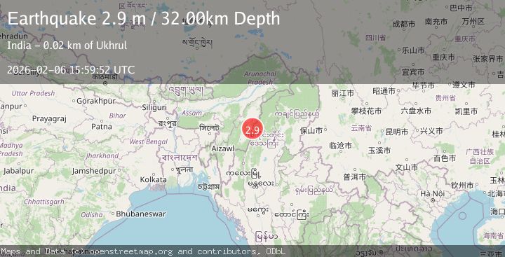
A 2.9 magnitude earthquake struck on MYANMAR-INDIA BORDER REGION, at Fri, 06 Feb 2026 15:59:52 GMT. Depth: 32km. Reviewed by NDI seismologists, this minor quake occurred at a magnitude type of m.
Magnitude
2.9
m
Source
NDI
Intensity
-
Agency Reports
1 Sources| Source | Magnitude | Depth | Time |
|---|---|---|---|
| NDIPrimary | 2.9 | 32 km | 8 hours ago |
Earthquake Details
AutomaticEvent IDemsc_NDI_20260206_0000283
Tsunami PotentialNo
Magnitude Typem
Nearest Places
- Hkayam Bum6.0 km
- Poi12.5 km
- Chammu13.6 km
- Longbi Hirei13.7 km
- Siruhi Kashong15.1 km
Comments
Join the discussion about this event.
Latest Earthquakes
2.3Mag
16 km S of Salton City, CA
Time6 hours ago
Depth6.45 km
SourceUSGS (Automatic)
2.4Mag
Northern Sumatra, Indonesia
Time6 hours ago
Depth67.73 km
SourceBMKG (Automatic)
2.1Mag
89 km NW of Yakutat, Alaska
Time6 hours ago
Depth17.50 km
SourceUSGS (Automatic)
1.1Mag
8 km W of Cobb, CA
Time6 hours ago
Depth1.47 km
SourceUSGS (Automatic)
3.9Mag
CRETE, GREECE
Time6 hours ago
Depth2.40 km
SourceEMSC (Automatic)
Nearby Earthquakes
4.2Mag
MYANMAR-INDIA BORDER REGION
Time1 week ago
Depth105.50 km
SourceNDI (Automatic)
4.0Mag
MYANMAR-INDIA BORDER REGION
Time2 weeks ago
Depth90.00 km
SourceNDI (Automatic)
4.4Mag
MANIPUR, INDIA REGION
Time2 weeks ago
Depth10.00 km
SourceNDI (Automatic)
3.6Mag
MYANMAR-INDIA BORDER REGION
Time1 week ago
Depth80.00 km
SourceNDI (Automatic)
3.9Mag
MYANMAR-INDIA BORDER REGION
Time1 week ago
Depth93.00 km
SourceNDI (Automatic)