Earthquake ISLAND OF HAWAII, HAWAII
Sat, 14 Aug 2021 23:42:53 GMT
Time4 years ago
Location
19.2200, -155.4900
Depth
35.0 KM
Event Summary
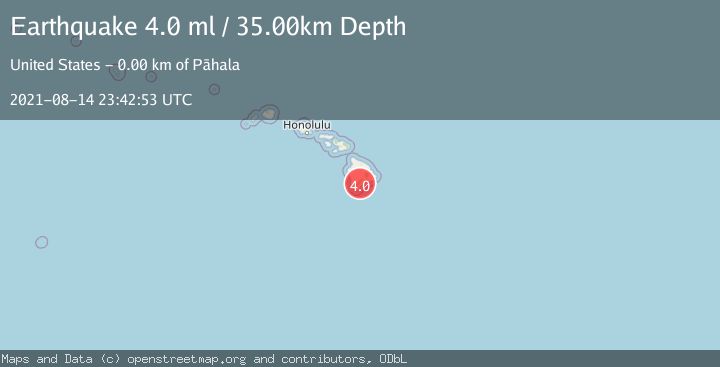
A 4.0 magnitude earthquake struck on ISLAND OF HAWAII, HAWAII, at Sat, 14 Aug 2021 23:42:53 GMT. Depth: 35km. Reviewed by NEIC seismologists, this light quake occurred at a magnitude type of ml.
Magnitude
4.0
ml
Source
NEIC
Intensity
-
Agency Reports
1 Sources| Source | Magnitude | Depth | Time |
|---|---|---|---|
| NEICPrimary | 4.0 | 35 km | 4 years ago |
Earthquake Details
AutomaticEvent IDemsc_NEIC_20210814_0000332
Tsunami PotentialNo
Magnitude Typeml
Nearest Places
- Meyer Camp (historical)0.2 km
- Meyer Reservoir0.6 km
- Kauhuhu‘ula1.4 km
- Pālima1.5 km
- Kauhuhu‘ula Gulch1.6 km
Comments
Join the discussion about this event.
Latest Earthquakes
1.6Mag
Alaska Peninsula
Time5 minutes ago
Depth15.63 km
SourceVYT (Automatic)
2.0Mag
Southern Sumatra, Indonesia
Time6 minutes ago
Depth22.20 km
SourceBMKG
2.2Mag
FRANCE
Time14 minutes ago
Depth5.00 km
SourceReNaSS (Automatic)
3.5Mag
Fox Islands, Aleutian Islands, Alaska
Time15 minutes ago
Depth72.63 km
SourceVYT (Automatic)
2.9Mag
STRAIT OF GIBRALTAR
Time15 minutes ago
Depth58.80 km
SourceIGN (Automatic)
Nearby Earthquakes
3.0Mag
ISLAND OF HAWAII, HAWAII
Time3 years ago
Depth14.00 km
SourceNEIC (Automatic)
3.0Mag
ISLAND OF HAWAII, HAWAII
Time2 years ago
Depth34.30 km
SourceNEIC (Automatic)
4.5Mag
2 km NW of Pāhala, Hawaii
Time3 weeks ago
Depth33.60 km
SourceUSGS
1.8Mag
1 km NW of Pāhala, Hawaii
Time3 weeks ago
Depth33.59 km
SourceUSGS (Automatic)
3.0Mag
ISLAND OF HAWAII, HAWAII
Time3 years ago
Depth41.00 km
SourceNEIC (Automatic)