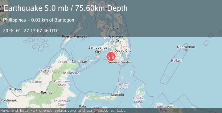
Earthquake MORO GULF, MINDANAO, PHILIPPINES
Tue, 27 Jan 2026 17:07:46 GMT
Time3 weeks ago
Location
6.5533, 123.9468
Depth
75.6 KM
Event Summary
A 5.0 magnitude earthquake struck on MORO GULF, MINDANAO, PHILIPPINES, at Tue, 27 Jan 2026 17:07:46 GMT. Depth: 75.6km. Reviewed by NEIC seismologists, this moderate quake occurred at a magnitude type of mb.
Magnitude
5.0
mb
Source
NEIC
Intensity
-
Agency Reports
1 Sources| Source | Magnitude | Depth | Time |
|---|---|---|---|
| NEICPrimary | 5.0 | 76 km | 3 weeks ago |
Earthquake Details
AutomaticEvent IDemsc_NEIC_20260127_0000501
Tsunami PotentialNo
Magnitude Typemb
Nearest Places
- Donaung Shoals5.3 km
- Nara Point8.5 km
- Pidtaguinan Point8.8 km
- Lebak Island9.6 km
- Bantogon9.8 km
Comments
Join the discussion about this event.
Latest Earthquakes
2.9Mag
Sumbawa Region, Indonesia
Time14 hours ago
Depth53.96 km
SourceBMKG
0.8Mag
Southern Alaska
Time14 hours ago
Depth15.50 km
SourceVYT (Automatic)
3.3Mag
Banda Sea
Time14 hours ago
Depth161.74 km
SourceVYT (Automatic)
4.4Mag
North of Halmahera, Indonesia
Time15 hours ago
Depth30.29 km
SourceBMKG
3.0Mag
Seram, Indonesia
Time15 hours ago
Depth3.59 km
SourceBMKG
Nearby Earthquakes
5.3Mag
MORO GULF, MINDANAO, PHILIPPINES
Time19 years ago
Depth55.00 km
SourceEMSC (Automatic)
5.8Mag
MORO GULF, MINDANAO, PHILIPPINES
Time13 years ago
Depth40.00 km
SourceEMSC (Automatic)
4.9Mag
Mindanao, Philippines
Time3 weeks ago
Depth52.86 km
SourceBMKG (Automatic)
3.0Mag
MORO GULF, MINDANAO, PHILIPPINES
Time1 year ago
Depth16.00 km
SourcePIVS (Automatic)
5.0Mag
MORO GULF, MINDANAO, PHILIPPINES
Time13 years ago
Depth10.00 km
SourceEMSC (Automatic)