Earthquake SOUTHERN ALASKA
Mon, 13 Jan 2014 02:26:22 GMT
Time12 years ago
Location
60.0000, -153.2400
Depth
156.0 KM
Event Summary
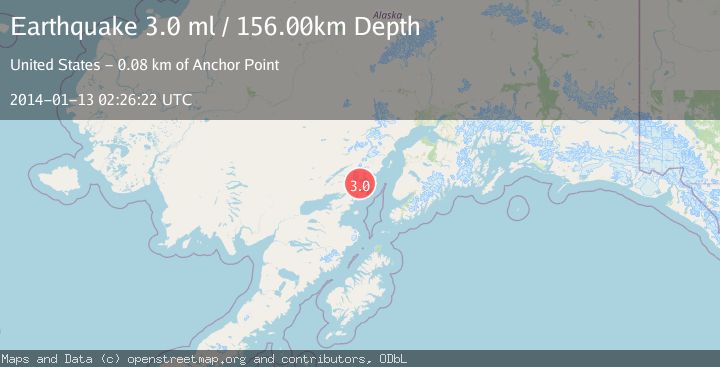
A 3.0 magnitude earthquake struck on SOUTHERN ALASKA, at Mon, 13 Jan 2014 02:26:22 GMT. Depth: 156km. Reviewed by NEIR seismologists, this minor quake occurred at a magnitude type of ml.
Magnitude
3.0
ml
Source
NEIR
Intensity
-
Agency Reports
1 Sources| Source | Magnitude | Depth | Time |
|---|---|---|---|
| NEIRPrimary | 3.0 | 156 km | 12 years ago |
Earthquake Details
AutomaticEvent IDemsc_NEIR_20140113_0000008
Tsunami PotentialNo
Magnitude Typeml
Nearest Places
- Umbrella Glacier5.1 km
- Tongue Glacier7.3 km
- Holland Creek8.3 km
- Right Fork West Glacier Creek8.4 km
- Left Fork West Glacier Creek8.4 km
Comments
Join the discussion about this event.
Latest Earthquakes
3.5Mag
COOK STRAIT, NEW ZEALAND
Time2 minutes ago
Depth75.30 km
SourceGNS (Automatic)
2.4Mag
Seram, Indonesia
Time3 minutes ago
Depth18.42 km
SourceBMKG
2.6Mag
West Papua Region, Indonesia
Time6 minutes ago
Depth17.35 km
SourceBMKG
2.8Mag
Antofagasta, Chile
Time10 minutes ago
Depth0.00 km
SourceVYT (Automatic)
3.3Mag
Near North Coast of West Papua
Time11 minutes ago
Depth10.00 km
SourceBMKG
Nearby Earthquakes
5.5Mag
SOUTHERN ALASKA
Time7 years ago
Depth146.00 km
SourceEMSC (Automatic)
3.0Mag
SOUTHERN ALASKA
Time7 years ago
Depth126.00 km
SourceNEIR (Automatic)
2.6Mag
SOUTHERN ALASKA
Time2 months ago
Depth135.60 km
SourceNEIC (Automatic)
1.5Mag
Southern Alaska
Time1 day ago
Depth67.26 km
SourceVYT (Automatic)
4.0Mag
SOUTHERN ALASKA
Time4 years ago
Depth130.00 km
SourceNEIC (Automatic)