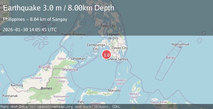
Earthquake MORO GULF, MINDANAO, PHILIPPINES
Fri, 30 Jan 2026 14:05:45 GMT
Time1 hour ago
Location
6.4400, 123.6800
Depth
8.0 KM
Event Summary
A 3.0 magnitude earthquake struck on MORO GULF, MINDANAO, PHILIPPINES, at Fri, 30 Jan 2026 14:05:45 GMT. Depth: 8km. Reviewed by PIVS seismologists, this minor quake occurred at a magnitude type of m.
Magnitude
3.0
m
Source
PIVS
Intensity
-
Agency Reports
1 Sources| Source | Magnitude | Depth | Time |
|---|---|---|---|
| PIVSPrimary | 3.0 | 8 km | 1 hour ago |
Earthquake Details
AutomaticEvent IDemsc_PIVS_20260130_0000225
Tsunami PotentialNo
Magnitude Typem
Nearest Places
- Donaung Shoals35.1 km
- Donauang Island37.9 km
- Basiauang Bay38.6 km
- Danawan Point38.8 km
- Basiauang Point38.9 km
Comments
Join the discussion about this event.
Latest Earthquakes
3.1Mag
SOUTH ISLAND OF NEW ZEALAND
Time2 hours ago
Depth87.70 km
SourceGNS (Automatic)
2.3Mag
Timor Region
Time2 hours ago
Depth59.59 km
SourceBMKG (Automatic)
2.4Mag
ISLAND OF HAWAII, HAWAII
Time2 hours ago
Depth29.90 km
SourceHV (Automatic)
2.3Mag
FRANCE
Time2 hours ago
Depth5.00 km
SourceReNaSS (Automatic)
2.5Mag
Java, Indonesia
Time2 hours ago
Depth21.00 km
SourceBMKG (Automatic)
Nearby Earthquakes
3.1Mag
MORO GULF, MINDANAO, PHILIPPINES
Time1 week ago
Depth10.00 km
SourcePIVS (Automatic)
3.6Mag
MORO GULF, MINDANAO, PHILIPPINES
Time4 days ago
Depth3.00 km
SourcePIVS (Automatic)
3.4Mag
MORO GULF, MINDANAO, PHILIPPINES
Time1 week ago
Depth9.00 km
SourcePIVS (Automatic)
3.5Mag
MORO GULF, MINDANAO, PHILIPPINES
Time2 days ago
Depth4.00 km
SourcePIVS (Automatic)
3.5Mag
MORO GULF, MINDANAO, PHILIPPINES
Time1 day ago
Depth6.00 km
SourcePIVS (Automatic)