Earthquake WESTERN TEXAS
Mon, 16 Feb 2026 16:50:47 GMT
Time1 day ago
Location
31.2090, -103.2670
Depth
8.2 KM
Event Summary
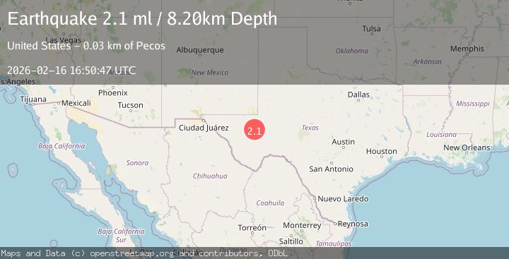
A 2.1 magnitude earthquake struck on WESTERN TEXAS, at Mon, 16 Feb 2026 16:50:47 GMT. Depth: 8.2km. Reviewed by TX seismologists, this minor quake occurred at a magnitude type of ml.
Magnitude
2.1
ml
Source
TX
Intensity
-
Agency Reports
2 Sources| Source | Magnitude | Depth | Time |
|---|---|---|---|
| TXPrimary | 2.1 | 8 km | 1 day ago |
| USGS | 2.0 | 7 km | 1 day ago |
Earthquake Details
AutomaticEvent IDemsc_TX_20260216_0000245
Tsunami PotentialNo
Magnitude Typeml
Nearest Places
- Flat Top Farm6.2 km
- Toro Gas Field6.3 km
- Old X Ranch7.6 km
- Weatherby Ranch12.2 km
- Smithers Emitter Site13.2 km
Comments
Join the discussion about this event.
Latest Earthquakes
2.2Mag
45 km SW of Karluk, Alaska
Time21 hours ago
Depth60.60 km
SourceUSGS (Automatic)
2.6Mag
Antofagasta, Chile
Time21 hours ago
Depth0.00 km
SourceVYT (Automatic)
2.3Mag
Poland
Time21 hours ago
Depth0.00 km
SourceVYT (Automatic)
4.9Mag
Minahasa, Sulawesi, Indonesia
Time21 hours ago
Depth93.63 km
SourceVYT (Automatic)
3.5Mag
PERU-ECUADOR BORDER REGION
Time21 hours ago
Depth64.00 km
SourceQUI (Automatic)
Nearby Earthquakes
1.5Mag
19 km W of Coyanosa, Texas
Time5 days ago
Depth5.13 km
SourceUSGS (Automatic)
1.7Mag
20 km W of Coyanosa, Texas
Time1 day ago
Depth5.17 km
SourceUSGS (Automatic)
3.0Mag
WESTERN TEXAS
Time3 years ago
Depth5.00 km
SourceNEIC (Automatic)
3.0Mag
WESTERN TEXAS
Time6 years ago
Depth5.00 km
SourceNEIC (Automatic)
3.0Mag
WESTERN TEXAS
Time6 years ago
Depth5.00 km
SourceNEIC (Automatic)