Earthquake 98 km N of Yakutat, Alaska
Fri, 02 Jan 2026 00:33:53 GMT
Time11 hours ago
Location
60.4140, -139.4020
Depth
0.0 KM
Event Summary
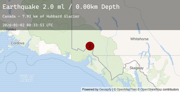
A 2.0 magnitude earthquake struck on 98 km N of Yakutat, Alaska, at Fri, 02 Jan 2026 00:33:53 GMT. Depth: 0km. Reviewed by USGS seismologists, this minor quake occurred at a magnitude type of ml.
Magnitude
2.0
ml
Source
USGS
Intensity
-
Agency Reports
1 Sources| Source | Magnitude | Depth | Time |
|---|---|---|---|
| USGSPrimary | 2.0 | 0 km | 11 hours ago |
Earthquake Details
ConfirmedEvent IDusgs_ak2026abwwcz
Tsunami PotentialNo
Magnitude Typeml
Nearest Places
- Hubbard Glacier7.9 km
- Hubbard Glacier11.3 km
- St. Elias Mountains15.5 km
- Alverstone Glacier16.2 km
- Icefield Ranges16.9 km
Comments
Join the discussion about this event.
Latest Earthquakes
1.9Mag
1 km W of Pāhala, Hawaii
Time9 hours ago
Depth33.72 km
SourceUSGS (Automatic)
3.1Mag
West Papua, Indonesia
Time10 hours ago
Depth16.31 km
SourceBMKG (Automatic)
1.6Mag
WESTERN TURKEY
Time10 hours ago
Depth13.40 km
SourceEMSC (Automatic)
3.3Mag
JUJUY, ARGENTINA
Time10 hours ago
Depth162.00 km
SourceNSNA (Automatic)
2.8Mag
ANTOFAGASTA, CHILE
Time10 hours ago
Depth118.60 km
SourceCSN (Automatic)
Nearby Earthquakes
1.9Mag
80 km NW of Yakutat, Alaska
Time15 hours ago
Depth8.20 km
SourceUSGS (Automatic)
2.7Mag
106 km N of Yakutat, Alaska
Time20 hours ago
Depth5.00 km
SourceUSGS
3.8Mag
101 km N of Yakutat, Alaska
Time22 hours ago
Depth1.90 km
SourceUSGS
3.8Mag
SOUTHERN YUKON TERRITORY, CANADA
Time22 hours ago
Depth1.90 km
SourceEMSC (Automatic)
3.7Mag
111 km N of Yakutat, Alaska
Time22 hours ago
Depth5.00 km
SourceUSGS