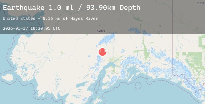
Earthquake 23 km W of Skwentna, Alaska
Sat, 17 Jan 2026 10:30:05 GMT
Time2 hours ago
Location
62.0150, -151.8450
Depth
93.9 KM
Event Summary
A 1.7 magnitude earthquake struck on 23 km W of Skwentna, Alaska, at Sat, 17 Jan 2026 10:30:05 GMT. Depth: 93.9km. Reviewed by USGS seismologists, this minor quake occurred at a magnitude type of ml.
Magnitude
1.7
ml
Source
USGS
Intensity
-
Agency Reports
1 Sources| Source | Magnitude | Depth | Time |
|---|---|---|---|
| USGSPrimary | 1.7 | 94 km | 2 hours ago |
Earthquake Details
AutomaticEvent IDusgs_ak2026beenaz
Tsunami PotentialNo
Magnitude Typeml
Nearest Places
- Hayes River8.2 km
- Tranquility Lake11.5 km
- Patrick Lake11.6 km
- Porcupine Butte11.8 km
- Red Salmon Lake11.9 km
Comments
Join the discussion about this event.
Latest Earthquakes
2.6Mag
Northern Sumatra, Indonesia
Time2 minutes ago
Depth1.53 km
SourceBMKG (Automatic)
4.1Mag
SOUTHWESTERN RYUKYU ISL., JAPAN
Time7 minutes ago
Depth20.00 km
SourceJMA (Automatic)
1.8Mag
126 km SSE of McCarthy, Alaska
Time8 minutes ago
Depth6.10 km
SourceUSGS (Automatic)
2.1Mag
58 km SSE of King Salmon, Alaska
Time12 minutes ago
Depth7.50 km
SourceUSGS (Automatic)
2.5Mag
South of Bali, Indonesia
Time25 minutes ago
Depth31.57 km
SourceBMKG (Automatic)