Earthquake 97 km NW of Yakutat, Alaska
Sun, 08 Feb 2026 00:22:32 GMT
Time1 hour ago
Location
60.1500, -140.9780
Depth
1.8 KM
Event Summary
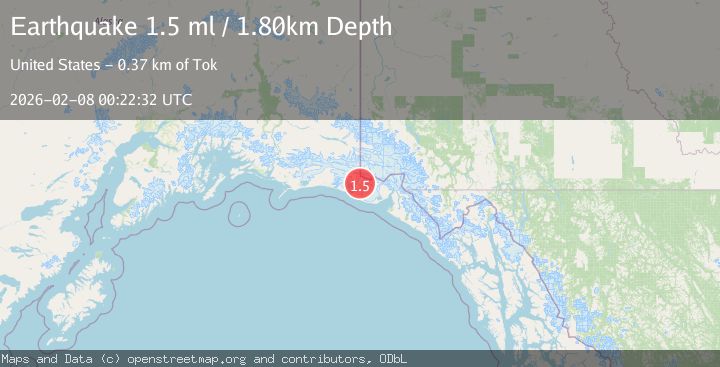
A 1.5 magnitude earthquake struck on 97 km NW of Yakutat, Alaska, at Sun, 08 Feb 2026 00:22:32 GMT. Depth: 1.8km. Reviewed by USGS seismologists, this minor quake occurred at a magnitude type of ml.
Magnitude
1.5
ml
Source
USGS
Intensity
-
Agency Reports
1 Sources| Source | Magnitude | Depth | Time |
|---|---|---|---|
| USGSPrimary | 1.5 | 2 km | 1 hour ago |
Earthquake Details
AutomaticEvent IDusgs_ak2026cruiwo
Tsunami PotentialNo
Magnitude Typeml
Nearest Places
- Agassiz Lakes1.8 km
- Libbey Glacier3.3 km
- Hoof Hill7.9 km
- Moore Nunatak8.5 km
- Crater Lake10.1 km
Comments
Join the discussion about this event.
Latest Earthquakes
1.5Mag
15 km W of Johannesburg, CA
Time5 minutes ago
Depth4.07 km
SourceUSGS (Automatic)
1.8Mag
24 km NW of Parkfield, CA
Time10 minutes ago
Depth5.26 km
SourceUSGS (Automatic)
1.3Mag
9 km N of Redwood Valley, CA
Time14 minutes ago
Depth7.67 km
SourceUSGS (Automatic)
1.1Mag
12 km WSW of Stanton, Texas
Time20 minutes ago
Depth4.41 km
SourceUSGS (Automatic)
1.9Mag
48 km SSE of Nelchina, Alaska
Time20 minutes ago
Depth22.00 km
SourceUSGS (Automatic)
Nearby Earthquakes
1.6Mag
98 km NW of Yakutat, Alaska
Time1 day ago
Depth23.10 km
SourceUSGS (Automatic)
1.9Mag
88 km NW of Yakutat, Alaska
Time1 week ago
Depth17.80 km
SourceUSGS (Automatic)
2.1Mag
89 km NW of Yakutat, Alaska
Time1 day ago
Depth17.50 km
SourceUSGS (Automatic)
2.2Mag
110 km NW of Yakutat, Alaska
Time2 weeks ago
Depth16.90 km
SourceUSGS (Automatic)
2.0Mag
89 km NW of Yakutat, Alaska
Time1 day ago
Depth15.80 km
SourceUSGS (Automatic)