Earthquake 64 km N of Petersville, Alaska
Sun, 08 Feb 2026 21:29:39 GMT
Time2 hours ago
Location
63.0650, -150.9700
Depth
132.3 KM
Event Summary
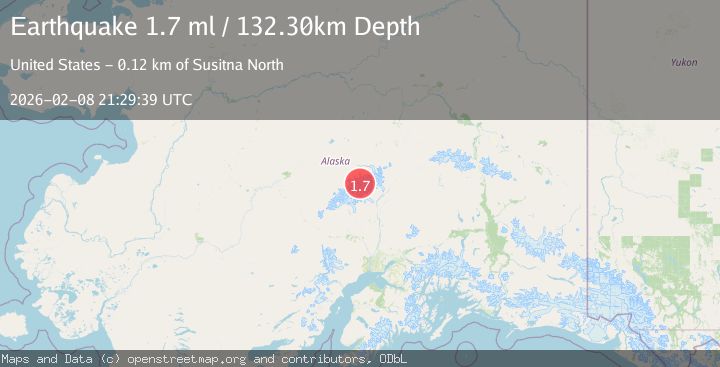
A 1.7 magnitude earthquake struck on 64 km N of Petersville, Alaska, at Sun, 08 Feb 2026 21:29:39 GMT. Depth: 132.3km. Reviewed by USGS seismologists, this minor quake occurred at a magnitude type of ml.
Magnitude
1.7
ml
Source
USGS
Intensity
-
Agency Reports
1 Sources| Source | Magnitude | Depth | Time |
|---|---|---|---|
| USGSPrimary | 1.7 | 132 km | 2 hours ago |
Earthquake Details
AutomaticEvent IDusgs_ak2026ctkiuk
Tsunami PotentialNo
Magnitude Typeml
Nearest Places
- Carter Horn1.5 km
- Thayer Basin1.6 km
- Farthing Horn1.8 km
- South Peak1.9 km
- Churchill Peaks1.9 km
Comments
Join the discussion about this event.
Latest Earthquakes
2.1Mag
Minahassa Peninsula, Sulawesi
Time3 minutes ago
Depth7.09 km
SourceBMKG (Automatic)
0.3Mag
14 km SW of Searles Valley, CA
Time5 minutes ago
Depth6.31 km
SourceUSGS (Automatic)
3.2Mag
MINDORO, PHILIPPINES
Time13 minutes ago
Depth111.00 km
SourcePIVS (Automatic)
2.7Mag
CRETE, GREECE
Time16 minutes ago
Depth20.80 km
SourceNOA (Automatic)
1.5Mag
STRAIT OF GIBRALTAR
Time20 minutes ago
Depth0.00 km
SourceIGN (Automatic)
Nearby Earthquakes
2.8Mag
63 km SE of Denali National Park, Alaska
Time1 week ago
Depth123.60 km
SourceUSGS (Automatic)
2.0Mag
64 km N of Petersville, Alaska
Time1 week ago
Depth113.50 km
SourceUSGS (Automatic)
2.3Mag
63 km SE of Denali National Park, Alaska
Time1 week ago
Depth127.50 km
SourceUSGS (Automatic)
2.1Mag
66 km N of Petersville, Alaska
Time2 days ago
Depth114.50 km
SourceUSGS (Automatic)
1.4Mag
54 km N of Petersville, Alaska
Time1 week ago
Depth124.00 km
SourceUSGS (Automatic)