Earthquake 49 km WNW of Salamatof, Alaska
Mon, 09 Feb 2026 04:13:13 GMT
Time1 hour ago
Location
60.7290, -152.1990
Depth
93.4 KM
Event Summary
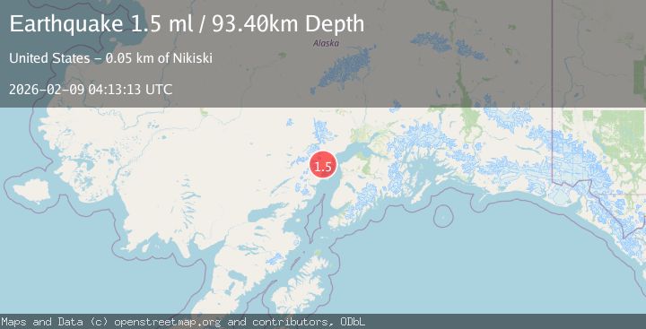
A 1.5 magnitude earthquake struck on 49 km WNW of Salamatof, Alaska, at Mon, 09 Feb 2026 04:13:13 GMT. Depth: 93.4km. Reviewed by USGS seismologists, this minor quake occurred at a magnitude type of ml.
Magnitude
1.5
ml
Source
USGS
Intensity
-
Agency Reports
1 Sources| Source | Magnitude | Depth | Time |
|---|---|---|---|
| USGSPrimary | 1.5 | 93 km | 1 hour ago |
Earthquake Details
AutomaticEvent IDusgs_ak2026ctxsms
Tsunami PotentialNo
Magnitude Typeml
Nearest Places
- Redoubt Bay State Critical Habitat Area3.9 km
- South Fork Big River4.0 km
- North Fork Big River4.4 km
- Coach Butte6.2 km
- Fox Flats6.8 km
Comments
Join the discussion about this event.
Latest Earthquakes
1.1Mag
7 km NW of The Geysers, CA
Time6 minutes ago
Depth2.36 km
SourceUSGS (Automatic)
1.7Mag
10 km SW of Brentwood, CA
Time17 minutes ago
Depth10.49 km
SourceUSGS (Automatic)
1.2Mag
WESTERN TURKEY
Time21 minutes ago
Depth5.40 km
SourceAFAD (Automatic)
1.6Mag
7 km WSW of Beaumont, CA
Time29 minutes ago
Depth16.18 km
SourceUSGS (Automatic)
5.4Mag
OFF EAST COAST OF KAMCHATKA
Time29 minutes ago
Depth48.00 km
SourceEMSC (Automatic)
Nearby Earthquakes
1.8Mag
53 km WNW of Nikiski, Alaska
Time12 hours ago
Depth97.20 km
SourceUSGS (Automatic)
2.0Mag
66 km W of Salamatof, Alaska
Time1 week ago
Depth116.30 km
SourceUSGS (Automatic)
1.5Mag
27 km W of Salamatof, Alaska
Time3 days ago
Depth81.30 km
SourceUSGS
1.4Mag
70 km WNW of Nikiski, Alaska
Time17 hours ago
Depth129.20 km
SourceUSGS (Automatic)
2.5Mag
39 km WSW of Salamatof, Alaska
Time13 hours ago
Depth81.70 km
SourceUSGS (Automatic)