Earthquake 62 km WNW of Beluga, Alaska
Mon, 09 Feb 2026 13:54:18 GMT
Time7 hours ago
Location
61.3470, -152.1720
Depth
5.0 KM
Event Summary
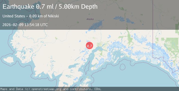
A 0.7 magnitude earthquake struck on 62 km WNW of Beluga, Alaska, at Mon, 09 Feb 2026 13:54:18 GMT. Depth: 5km. Reviewed by USGS seismologists, this minor quake occurred at a magnitude type of ml.
Magnitude
0.7
ml
Source
USGS
Intensity
-
Agency Reports
1 Sources| Source | Magnitude | Depth | Time |
|---|---|---|---|
| USGSPrimary | 0.7 | 5 km | 7 hours ago |
Earthquake Details
AutomaticEvent IDusgs_ak2026cuqzgr
Tsunami PotentialNo
Magnitude Typeml
Nearest Places
- The Rowel3.9 km
- Spurr Ice Plateau4.8 km
- Mount Chichantna5.6 km
- Mount Spurr6.8 km
- Dogshead Glacier8.0 km
Comments
Join the discussion about this event.
Latest Earthquakes
2.6Mag
Java, Indonesia
Time6 minutes ago
Depth113.39 km
SourceBMKG (Automatic)
1.1Mag
93 km SSE of King Salmon, Alaska
Time7 minutes ago
Depth5.00 km
SourceUSGS (Automatic)
3.3Mag
SIKKIM, INDIA
Time22 minutes ago
Depth5.00 km
SourceNDI (Automatic)
2.2Mag
Sumbawa Region, Indonesia
Time24 minutes ago
Depth31.11 km
SourceBMKG (Automatic)
1.0Mag
40 km SW of Silver Gate, Montana
Time24 minutes ago
Depth2.40 km
SourceUSGS
Nearby Earthquakes
0.7Mag
62 km WNW of Beluga, Alaska
Time6 days ago
Depth5.00 km
SourceUSGS (Automatic)
1.9Mag
68 km WNW of Beluga, Alaska
Time1 day ago
Depth5.00 km
SourceUSGS (Automatic)
3.1Mag
SOUTHERN ALASKA
Time2 weeks ago
Depth5.00 km
SourceAK (Automatic)
0.8Mag
57 km WNW of Tyonek, Alaska
Time2 weeks ago
Depth115.90 km
SourceUSGS (Automatic)
0.7Mag
70 km WNW of Tyonek, Alaska
Time5 days ago
Depth4.00 km
SourceUSGS (Automatic)