Earthquake 32 km NW of Nanwalek, Alaska
Tue, 10 Feb 2026 03:22:37 GMT
Time1 hour ago
Location
59.5580, -152.3230
Depth
65.5 KM
Event Summary
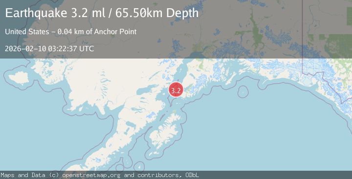
A 3.2 magnitude earthquake struck on 32 km NW of Nanwalek, Alaska, at Tue, 10 Feb 2026 03:22:37 GMT. Depth: 65.5km. Reviewed by USGS seismologists, this minor quake occurred at a magnitude type of ml.
Magnitude
3.2
ml
Source
USGS
Intensity
-
Agency Reports
1 Sources| Source | Magnitude | Depth | Time |
|---|---|---|---|
| USGSPrimary | 3.2 | 66 km | 1 hour ago |
Earthquake Details
AutomaticEvent IDusgs_ak2026cvrtva
Tsunami PotentialNo
Magnitude Typeml
Nearest Places
- Jakolof Bay15.6 km
- Point Pogibshi28.7 km
- Dangerous Cape Reef28.7 km
- Kachemak Bay29.2 km
- Dangerous Cape29.6 km
Comments
Join the discussion about this event.
Latest Earthquakes
3.4Mag
OFF COAST OF COSTA RICA
Time1 hour ago
Depth21.00 km
SourceINET (Automatic)
1.5Mag
6 km WNW of Cobb, CA
Time1 hour ago
Depth1.73 km
SourceUSGS (Automatic)
2.0Mag
82 km ENE of Ugashik, Alaska
Time1 hour ago
Depth119.60 km
SourceUSGS (Automatic)
3.2Mag
SOUTHERN ALASKA
Time1 hour ago
Depth65.50 km
SourceAK (Automatic)
1.0Mag
18 km NNE of Indio, CA
Time1 hour ago
Depth3.58 km
SourceUSGS (Automatic)
Nearby Earthquakes
3.2Mag
SOUTHERN ALASKA
Time1 hour ago
Depth65.50 km
SourceAK (Automatic)
2.5Mag
37 km WSW of Anchor Point, Alaska
Time1 week ago
Depth93.10 km
SourceUSGS (Automatic)
2.1Mag
20 km W of Anchor Point, Alaska
Time2 days ago
Depth66.90 km
SourceUSGS (Automatic)
2.1Mag
47 km W of Nanwalek, Alaska
Time4 days ago
Depth85.40 km
SourceUSGS (Automatic)
1.6Mag
57 km WSW of Anchor Point, Alaska
Time1 week ago
Depth96.00 km
SourceUSGS (Automatic)