Earthquake 67 km WNW of Beluga, Alaska
Mon, 16 Feb 2026 01:34:02 GMT
Time2 days ago
Location
61.3540, -152.2590
Depth
5.0 KM
Event Summary
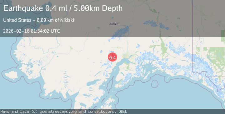
A 0.4 magnitude earthquake struck on 67 km WNW of Beluga, Alaska, at Mon, 16 Feb 2026 01:34:02 GMT. Depth: 5km. Reviewed by USGS seismologists, this minor quake occurred at a magnitude type of ml.
Magnitude
0.4
ml
Source
USGS
Intensity
-
Agency Reports
1 Sources| Source | Magnitude | Depth | Time |
|---|---|---|---|
| USGSPrimary | 0.4 | 5 km | 2 days ago |
Earthquake Details
AutomaticEvent IDusgs_ak2026dgonhu
Tsunami PotentialNo
Magnitude Typeml
Nearest Places
- Mount Chichantna2.5 km
- Spurr Ice Plateau4.0 km
- The Rowel5.7 km
- Mount Spurr6.0 km
- East Torbert Cirque7.1 km
Comments
Join the discussion about this event.
Latest Earthquakes
3.3Mag
Papua, Indonesia
Time17 hours ago
Depth3.17 km
SourceVYT (Automatic)
2.4Mag
Tarapaca, Chile
Time17 hours ago
Depth86.91 km
SourceVYT (Automatic)
1.1Mag
86 km NNW of Karluk, Alaska
Time17 hours ago
Depth5.00 km
SourceUSGS (Automatic)
2.2Mag
45 km SW of Karluk, Alaska
Time17 hours ago
Depth60.60 km
SourceUSGS (Automatic)
2.6Mag
Antofagasta, Chile
Time17 hours ago
Depth0.00 km
SourceVYT (Automatic)
Nearby Earthquakes
0.6Mag
Southern Alaska
Time5 days ago
Depth0.00 km
SourceVYT (Automatic)
0.9Mag
66 km WNW of Beluga, Alaska
Time6 days ago
Depth12.90 km
SourceUSGS (Automatic)
0.7Mag
Southern Alaska
Time5 days ago
Depth0.00 km
SourceVYT (Automatic)
0.8Mag
Southern Alaska
Time5 days ago
Depth2.81 km
SourceVYT (Automatic)
0.6Mag
Southern Alaska
Time4 days ago
Depth0.00 km
SourceVYT (Automatic)