Earthquake 27 km WSW of Westmorland, CA
Fri, 16 Jan 2026 10:57:10 GMT
Time6 hours ago
Location
32.9687, -115.8987
Depth
7.6 KM
Event Summary
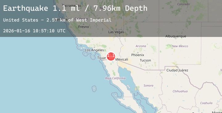
A 2.4 magnitude earthquake struck on 27 km WSW of Westmorland, CA, at Fri, 16 Jan 2026 10:57:10 GMT. Depth: 7.61km. Reviewed by USGS seismologists, this minor quake occurred at a magnitude type of ml.
Magnitude
2.4
ml
Source
USGS
Intensity
-
Agency Reports
6 Sources| Source | Magnitude | Depth | Time |
|---|---|---|---|
| USGSPrimary | 1.1 | 8 km | 6 hours ago |
| USGSPrimary | 1.9 | 9 km | 5 hours ago |
| USGSPrimary | 0.7 | 7 km | 5 hours ago |
| SCSN | 2.4 | 5 km | 5 hours ago |
| USGSPrimary | 2.4 | 5 km | 5 hours ago |
| USGSPrimary | 2.2 | 11 km | 5 hours ago |
Earthquake Details
AutomaticEvent IDusgs_ci41159575
Tsunami PotentialNo
Magnitude Typeml
Nearest Places
- West Imperial1.8 km
- Superstition Mountain7.0 km
- Fish Creek Mountains9.7 km
- Superstition Hills9.9 km
- Fish Creek Mountains Wilderness10.5 km
Comments
Join the discussion about this event.
Latest Earthquakes
1.8Mag
11 km ESE of Willits, CA
Time4 minutes ago
Depth6.40 km
SourceUSGS (Automatic)
1.7Mag
21 km ESE of Naalehu, Hawaii
Time10 minutes ago
Depth32.46 km
SourceUSGS (Automatic)
2.7Mag
Flores Sea
Time22 minutes ago
Depth177.42 km
SourceBMKG (Automatic)
5.5Mag
WESTERN INDIAN-ANTARCTIC RIDGE
Time24 minutes ago
Depth10.00 km
SourceNEIC (Automatic)
1.8Mag
5 km NNW of Glen Avon, CA
Time32 minutes ago
Depth4.03 km
SourceUSGS (Automatic)
Nearby Earthquakes
2.2Mag
15 km N of Warner Springs, CA
Time2 hours ago
Depth4.66 km
SourceUSGS (Automatic)
1.4Mag
21 km ESE of Anza, CA
Time8 hours ago
Depth4.45 km
SourceUSGS (Automatic)
2.1Mag
SOUTHERN CALIFORNIA
Time10 hours ago
Depth9.50 km
SourceSCSN (Automatic)
1.2Mag
26 km WSW of Westmorland, CA
Time14 hours ago
Depth9.33 km
SourceUSGS (Automatic)
1.5Mag
9 km ENE of Heber, CA
Time15 hours ago
Depth13.28 km
SourceUSGS (Automatic)