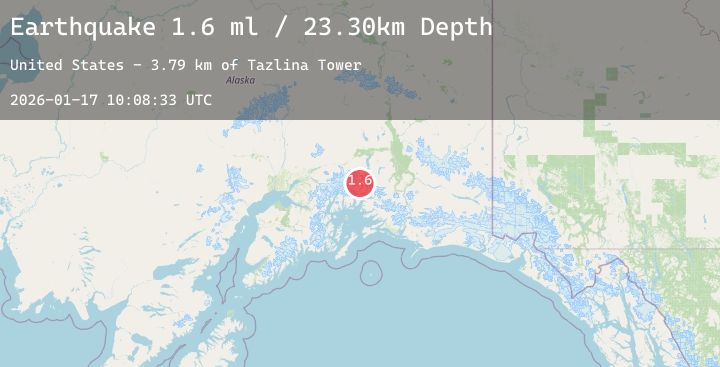
Earthquake 40 km NW of Valdez, Alaska
Sat, 17 Jan 2026 10:08:33 GMT
Time1 hour ago
Location
61.4160, -146.8030
Depth
23.3 KM
Event Summary
A 2.1 magnitude earthquake struck on 40 km NW of Valdez, Alaska, at Sat, 17 Jan 2026 10:08:33 GMT. Depth: 23.3km. Reviewed by USGS seismologists, this minor quake occurred at a magnitude type of ml.
Magnitude
2.1
ml
Source
USGS
Intensity
-
Agency Reports
2 Sources| Source | Magnitude | Depth | Time |
|---|---|---|---|
| USGSPrimary | 1.6 | 23 km | 1 hour ago |
| USGSPrimary | 2.1 | 11 km | 1 hour ago |
Earthquake Details
AutomaticEvent IDusgs_ak2026bedums
Tsunami PotentialNo
Magnitude Typeml
Nearest Places
- Tazlina Tower3.8 km
- Mount Powder Top4.9 km
- Madean Peak4.9 km
- Audubon Mountain6.2 km
- Flat Top Peak6.8 km
Comments
Join the discussion about this event.
Latest Earthquakes
2.1Mag
31 km NW of Toyah, Texas
Time4 minutes ago
Depth4.46 km
SourceUSGS (Automatic)
3.1Mag
Off West Coast of Northern Sumatra
Time14 minutes ago
Depth40.28 km
SourceBMKG (Automatic)
2.5Mag
HONDURAS
Time16 minutes ago
Depth11.00 km
SourceINET (Automatic)
2.2Mag
Flores Region, Indonesia
Time16 minutes ago
Depth11.17 km
SourceBMKG (Automatic)
3.6Mag
West Papua Region, Indonesia
Time20 minutes ago
Depth10.00 km
SourceBMKG (Automatic)