Earthquake 14 km SW of Searles Valley, CA
Mon, 02 Feb 2026 05:17:19 GMT
Time21 hours ago
Location
35.6702, -117.4960
Depth
4.2 KM
Event Summary
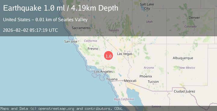
A 1.0 magnitude earthquake struck on 14 km SW of Searles Valley, CA, at Mon, 02 Feb 2026 05:17:19 GMT. Depth: 4.19000005722046km. Reviewed by USGS seismologists, this minor quake occurred at a magnitude type of ml.
Magnitude
1.0
ml
Source
USGS
Intensity
-
Agency Reports
1 Sources| Source | Magnitude | Depth | Time |
|---|---|---|---|
| USGSPrimary | 1.0 | 4 km | 21 hours ago |
Earthquake Details
AutomaticEvent IDusgs_ci41177991
Tsunami PotentialNo
Magnitude Typeml
Nearest Places
- Salt Wells Valley1.5 km
- The Y3.0 km
- Skytop3.5 km
- Trona Water Pipeline3.9 km
- Fish Head Rocks6.0 km
Comments
Join the discussion about this event.
Latest Earthquakes
1.7Mag
44 km NW of Tatitlek, Alaska
Time2 hours ago
Depth5.00 km
SourceUSGS (Automatic)
2.1Mag
Sumbawa Region, Indonesia
Time2 hours ago
Depth10.00 km
SourceBMKG (Automatic)
1.8Mag
4 km SE of San Ramon, CA
Time2 hours ago
Depth6.96 km
SourceUSGS (Automatic)
3.3Mag
Java, Indonesia
Time2 hours ago
Depth90.20 km
SourceBMKG (Automatic)
4.3Mag
TARAPACA, CHILE
Time2 hours ago
Depth54.00 km
SourceCSLC (Automatic)
Nearby Earthquakes
1.2Mag
14 km SW of Searles Valley, CA
Time1 week ago
Depth4.54 km
SourceUSGS (Automatic)
1.4Mag
15 km ENE of Ridgecrest, CA
Time1 week ago
Depth7.69 km
SourceUSGS (Automatic)
0.7Mag
13 km ENE of Ridgecrest, CA
Time2 days ago
Depth7.22 km
SourceUSGS (Automatic)
1.1Mag
12 km ENE of Ridgecrest, CA
Time1 week ago
Depth6.28 km
SourceUSGS (Automatic)
1.3Mag
15 km NE of Ridgecrest, CA
Time1 week ago
Depth10.03 km
SourceUSGS (Automatic)