Earthquake 8 km SSW of Mojave, CA
Mon, 09 Feb 2026 19:51:43 GMT
Time1 hour ago
Location
34.9847, -118.1927
Depth
1.9 KM
Event Summary
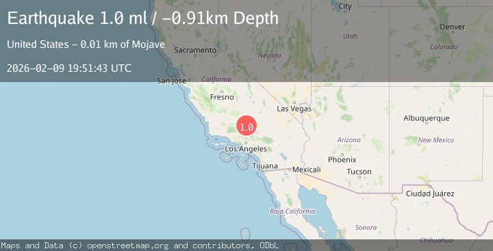
A 1.1 magnitude earthquake struck on 8 km SSW of Mojave, CA, at Mon, 09 Feb 2026 19:51:43 GMT. Depth: 1.87km. Reviewed by USGS seismologists, this minor quake occurred at a magnitude type of ml.
Magnitude
1.1
ml
Source
USGS
Intensity
-
Agency Reports
1 Sources| Source | Magnitude | Depth | Time |
|---|---|---|---|
| USGSPrimary | 1.1 | 2 km | 1 hour ago |
Earthquake Details
AutomaticEvent IDusgs_ci41394632
Tsunami PotentialNo
Magnitude Typeml
Nearest Places
- Golden Queen Mine0.4 km
- Soledad Mountain0.5 km
- Bobtail Mines0.7 km
- Elephant Eagle Mine1.0 km
- Tip Top Mine1.9 km
Comments
Join the discussion about this event.
Latest Earthquakes
2.2Mag
Sumbawa Region, Indonesia
Time7 minutes ago
Depth31.11 km
SourceBMKG (Automatic)
3.5Mag
Banda Sea
Time10 minutes ago
Depth133.12 km
SourceBMKG (Automatic)
2.1Mag
WESTERN TEXAS
Time11 minutes ago
Depth6.80 km
SourceTX (Automatic)
2.1Mag
Sulawesi, Indonesia
Time15 minutes ago
Depth10.00 km
SourceBMKG (Automatic)
2.7Mag
Java, Indonesia
Time16 minutes ago
Depth13.54 km
SourceBMKG (Automatic)
Nearby Earthquakes
1.2Mag
7 km S of Mojave, CA
Time1 week ago
Depth-0.84 km
SourceUSGS (Automatic)
1.2Mag
8 km SSW of Mojave, CA
Time1 week ago
Depth1.66 km
SourceUSGS (Automatic)
1.7Mag
6 km S of Mojave, CA
Time2 weeks ago
Depth7.87 km
SourceUSGS (Automatic)
2.0Mag
14 km WSW of Mojave, CA
Time1 week ago
Depth7.99 km
SourceUSGS (Automatic)
1.3Mag
14 km W of Mojave, CA
Time1 week ago
Depth0.37 km
SourceUSGS (Automatic)