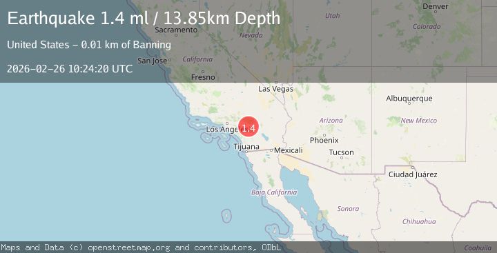
Earthquake 6 km SSE of Banning, CA
Thu, 26 Feb 2026 10:24:20 GMT
Time1 hour ago
Location
33.8773, -116.8573
Depth
13.9 KM
Event Summary
A 1.4 magnitude earthquake struck on 6 km SSE of Banning, CA, at Thu, 26 Feb 2026 10:24:20 GMT. Depth: 13.8500003814697km. Reviewed by USGS seismologists, this minor quake occurred at a magnitude type of ml.
Magnitude
1.4
ml
Source
USGS
Intensity
-
Agency Reports
1 Sources| Source | Magnitude | Depth | Time |
|---|---|---|---|
| USGSPrimary | 1.4 | 14 km | 1 hour ago |
Earthquake Details
AutomaticEvent IDusgs_ci41404184
Tsunami PotentialNo
Magnitude Typeml
Nearest Places
- 1.9 km
- 2.0 km
- 2.0 km
- 2.2 km
- 2.8 km
Comments
Join the discussion about this event.
Latest Earthquakes
2.9Mag
Southern Sumatra, Indonesia
Time2 minutes ago
Depth24.78 km
SourceBMKG
2.2Mag
Sulawesi, Indonesia
Time4 minutes ago
Depth6.56 km
SourceBMKG
2.7Mag
OKLAHOMA
Time5 minutes ago
Depth4.50 km
SourceOK (Automatic)
2.8Mag
Java, Indonesia
Time7 minutes ago
Depth15.88 km
SourceBMKG
1.7Mag
Coquimbo, Chile
Time8 minutes ago
Depth0.00 km
SourceVYT (Automatic)
Nearby Earthquakes
4.0Mag
Southern California
Time1 week ago
Depth20.39 km
SourceVYT (Automatic)
1.1Mag
4 km SSE of Banning, CA
Time1 week ago
Depth15.73 km
SourceUSGS (Automatic)
0.9Mag
4 km SSE of Banning, CA
Time1 week ago
Depth12.80 km
SourceUSGS (Automatic)
1.5Mag
10 km SSE of Banning, CA
Time1 day ago
Depth15.38 km
SourceUSGS (Automatic)
2.3Mag
SOUTHERN CALIFORNIA
Time1 month ago
Depth6.70 km
SourceSCSN (Automatic)