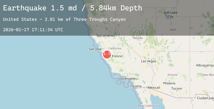
Earthquake 15 km S of Tres Pinos, CA
Sat, 17 Jan 2026 17:11:34 GMT
Time6 hours ago
Location
36.6560, -121.3043
Depth
5.8 KM
Event Summary
A 1.5 magnitude earthquake struck on 15 km S of Tres Pinos, CA, at Sat, 17 Jan 2026 17:11:34 GMT. Depth: 5.84000015258789km. Reviewed by USGS seismologists, this minor quake occurred at a magnitude type of md.
Magnitude
1.5
md
Source
USGS
Intensity
-
Agency Reports
1 Sources| Source | Magnitude | Depth | Time |
|---|---|---|---|
| USGSPrimary | 1.5 | 6 km | 6 hours ago |
Earthquake Details
AutomaticEvent IDusgs_nc75297151
Tsunami PotentialNo
Magnitude Typemd
Nearest Places
- Three Troughs Canyon2.0 km
- Alvisa Canyon2.2 km
- Thousand Trail Resort4.2 km
- Bear Canyon4.4 km
- Pescadero Creek4.5 km
Comments
Join the discussion about this event.
Latest Earthquakes
2.3Mag
Java, Indonesia
Time11 minutes ago
Depth8.25 km
SourceBMKG (Automatic)
2.6Mag
55 km WNW of Sitka, Alaska
Time11 minutes ago
Depth11.80 km
SourceUSGS (Automatic)
3.5Mag
MYANMAR-INDIA BORDER REGION
Time13 minutes ago
Depth65.00 km
SourceNDI (Automatic)
2.8Mag
CATAMARCA, ARGENTINA
Time15 minutes ago
Depth135.00 km
SourceNSNA (Automatic)
3.0Mag
SOUTH ISLAND OF NEW ZEALAND
Time17 minutes ago
Depth81.20 km
SourceGNS (Automatic)