Earthquake CENTRAL CALIFORNIA
Mon, 16 Feb 2026 12:52:49 GMT
Time2 days ago
Location
36.6428, -121.2935
Depth
6.0 KM
Event Summary
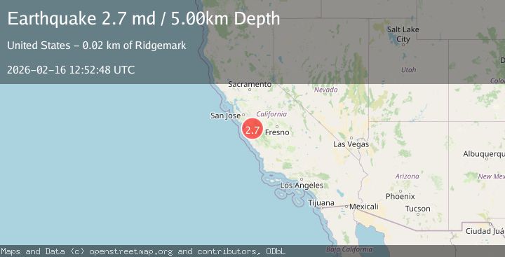
A 2.7 magnitude earthquake struck on CENTRAL CALIFORNIA, at Mon, 16 Feb 2026 12:52:49 GMT. Depth: 6km. Reviewed by NC seismologists, this minor quake occurred at a magnitude type of md.
Magnitude
2.7
md
Source
NC
Intensity
-
Agency Reports
3 Sources| Source | Magnitude | Depth | Time |
|---|---|---|---|
| NCPrimary | 2.7 | 6 km | 2 days ago |
| USGS | 2.7 | 6 km | 2 days ago |
| NEIC | 2.7 | 5 km | 2 days ago |
Earthquake Details
AutomaticEvent IDemsc_NC_20260216_0000178
Tsunami PotentialNo
Magnitude Typemd
Nearest Places
- Alvisa Canyon0.5 km
- Three Troughs Canyon0.8 km
- Bear Canyon3.1 km
- Gabilan Range4.0 km
- Mount Johnson4.0 km
Comments
Join the discussion about this event.
Latest Earthquakes
2.8Mag
Sunda Strait, Indonesia
Time5 hours ago
Depth3.61 km
SourceBMKG
3.6Mag
south of Alaska
Time5 hours ago
Depth10.00 km
SourceVYT (Automatic)
1.2Mag
Central Alaska
Time5 hours ago
Depth68.97 km
SourceVYT (Automatic)
1.2Mag
Washington
Time5 hours ago
Depth0.00 km
SourceVYT (Automatic)
0.8Mag
10 km WNW of The Geysers, CA
Time6 hours ago
Depth1.96 km
SourceUSGS (Automatic)
Nearby Earthquakes
1.3Mag
17 km S of Tres Pinos, CA
Time1 week ago
Depth6.61 km
SourceUSGS (Automatic)
2.6Mag
CENTRAL CALIFORNIA
Time2 weeks ago
Depth6.20 km
SourceNC (Automatic)
1.2Mag
17 km S of Tres Pinos, CA
Time2 weeks ago
Depth5.50 km
SourceUSGS (Automatic)
1.2Mag
17 km S of Tres Pinos, CA
Time2 weeks ago
Depth6.76 km
SourceUSGS (Automatic)
1.5Mag
17 km S of Tres Pinos, CA
Time3 weeks ago
Depth5.66 km
SourceUSGS (Automatic)