Earthquake 43 km NW of Toyah, Texas
Sat, 17 Jan 2026 20:52:05 GMT
Time2 hours ago
Location
31.6110, -104.0940
Depth
4.2 KM
Event Summary
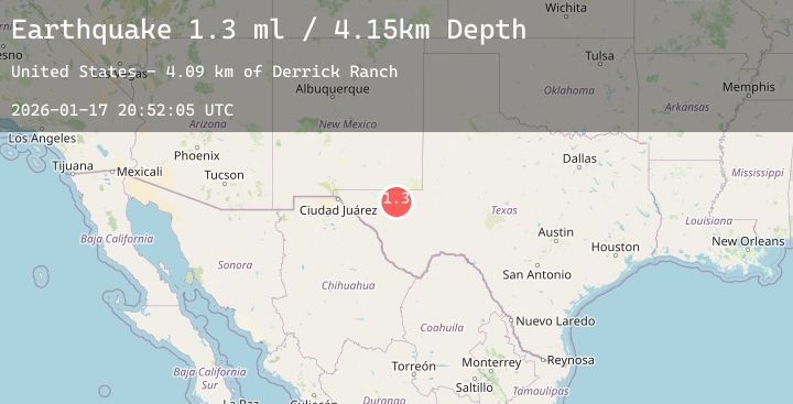
A 1.6 magnitude earthquake struck on 43 km NW of Toyah, Texas, at Sat, 17 Jan 2026 20:52:05 GMT. Depth: 4.1526km. Reviewed by USGS seismologists, this minor quake occurred at a magnitude type of ml.
Magnitude
1.6
ml
Source
USGS
Intensity
-
Agency Reports
2 Sources| Source | Magnitude | Depth | Time |
|---|---|---|---|
| USGSPrimary | 1.3 | 4 km | 2 hours ago |
| USGSPrimary | 1.6 | 5 km | 1 hour ago |
Earthquake Details
AutomaticEvent IDusgs_tx2026bezdbs
Tsunami PotentialNo
Magnitude Typeml
Nearest Places
- Derrick Ranch4.1 km
- Dry Lake8.2 km
- Monument Windmill8.8 km
- Old Michigan Mine8.8 km
- Monument Draw9.0 km
Comments
Join the discussion about this event.
Latest Earthquakes
1.6Mag
10 km W of Houston, Alaska
Time4 minutes ago
Depth29.10 km
SourceUSGS (Automatic)
1.4Mag
7 km NE of Coso Junction, CA
Time8 minutes ago
Depth5.55 km
SourceUSGS (Automatic)
2.0Mag
PUERTO RICO REGION
Time11 minutes ago
Depth12.70 km
SourcePR (Automatic)
1.6Mag
14 km SSW of Mentone, Texas
Time19 minutes ago
Depth0.00 km
SourceUSGS (Automatic)
2.9Mag
Sunda Strait, Indonesia
Time20 minutes ago
Depth74.26 km
SourceBMKG (Automatic)
Nearby Earthquakes
1.6Mag
14 km SSW of Mentone, Texas
Time19 minutes ago
Depth0.00 km
SourceUSGS (Automatic)
1.9Mag
31 km NW of Toyah, Texas
Time6 hours ago
Depth3.95 km
SourceUSGS (Automatic)
1.7Mag
31 km NW of Toyah, Texas
Time9 hours ago
Depth4.52 km
SourceUSGS (Automatic)
3.3Mag
31 km NW of Toyah, Texas
Time11 hours ago
Depth4.46 km
SourceUSGS (Automatic)
1.8Mag
58 km NW of Toyah, Texas
Time12 hours ago
Depth4.17 km
SourceUSGS (Automatic)