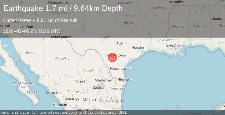
Earthquake 13 km ESE of Pearsall, Texas
Thu, 05 Feb 2026 05:51:36 GMT
Time1 hour ago
Location
28.8250, -98.9790
Depth
9.6 KM
Event Summary
A 1.7 magnitude earthquake struck on 13 km ESE of Pearsall, Texas, at Thu, 05 Feb 2026 05:51:36 GMT. Depth: 9.6406km. Reviewed by USGS seismologists, this minor quake occurred at a magnitude type of ml.
Magnitude
1.7
ml
Source
USGS
Intensity
-
Agency Reports
1 Sources| Source | Magnitude | Depth | Time |
|---|---|---|---|
| USGSPrimary | 1.7 | 10 km | 1 hour ago |
Earthquake Details
AutomaticEvent IDusgs_tx2026cmsbuo
Tsunami PotentialNo
Magnitude Typeml
Nearest Places
- Jay Kay Ranch Airport3.4 km
- Buckhorn Cemetery5.0 km
- Shipping Trap Windmill5.2 km
- Keystone Ranch6.3 km
- Shiner Windmill6.4 km
Comments
Join the discussion about this event.
Latest Earthquakes
3.8Mag
South of Java, Indonesia
Time10 minutes ago
Depth10.00 km
SourceBMKG (Automatic)
2.6Mag
South of Sumbawa, Indonesia
Time21 minutes ago
Depth10.00 km
SourceBMKG (Automatic)
1.5Mag
33 km E of Balmorhea, Texas
Time21 minutes ago
Depth5.46 km
SourceUSGS (Automatic)
3.3Mag
MOLUCCA SEA
Time24 minutes ago
Depth28.00 km
SourceBMKG (Automatic)
1.2Mag
8 km W of Cobb, CA
Time30 minutes ago
Depth1.89 km
SourceUSGS (Automatic)
Nearby Earthquakes
1.8Mag
10 km ESE of Pearsall, Texas
Time2 days ago
Depth8.90 km
SourceUSGS (Automatic)
2.0Mag
8 km ESE of Pearsall, Texas
Time1 day ago
Depth9.54 km
SourceUSGS (Automatic)
1.8Mag
10 km ESE of Pearsall, Texas
Time19 hours ago
Depth9.85 km
SourceUSGS (Automatic)
1.9Mag
11 km E of Pearsall, Texas
Time1 week ago
Depth13.00 km
SourceUSGS (Automatic)
2.4Mag
SOUTHERN TEXAS
Time4 days ago
Depth6.00 km
SourceTX (Automatic)