Earthquake 106 km NW of Yakutat, Alaska
Fri, 13 Feb 2026 21:37:15 GMT
Time4 days ago
Location
60.2520, -141.0000
Depth
14.4 KM
Event Summary
A 1.6 magnitude earthquake struck on 106 km NW of Yakutat, Alaska, at Fri, 13 Feb 2026 21:37:15 GMT. Depth: 14.4km. Reviewed by USGS seismologists, this minor quake occurred at a magnitude type of ml.
Magnitude
1.6
ml
Source
USGS
Intensity
-
Agency Reports
2 Sources| Source | Magnitude | Depth | Time |
|---|---|---|---|
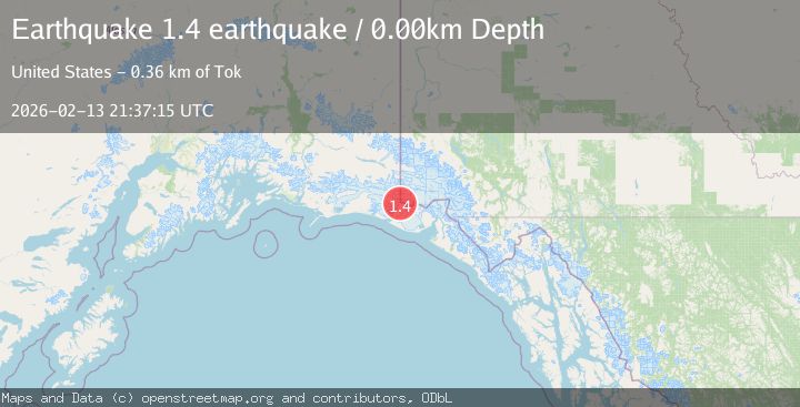
| USGSPrimary | 1.6 | 14 km | 4 days ago |
| VYT | 1.4 | 0 km | 4 days ago |
Earthquake Details
AutomaticEvent IDusgs_ak2026dcpfsp
Tsunami PotentialNo
Magnitude Typeml
Nearest Places
- Haydon Peak1.1 km
- Mount Saint Elias6.0 km
- Boundary Peak 1876.2 km
- The Hump8.4 km
- Russell Col8.9 km
Comments
Join the discussion about this event.
Latest Earthquakes
3.2Mag
NORTH ISLAND OF NEW ZEALAND
Time18 hours ago
Depth114.60 km
SourceGNS (Automatic)
3.0Mag
Kepulauan Sula, Indonesia
Time18 hours ago
Depth275.15 km
SourceVYT (Automatic)
2.4Mag
Tarapaca, Chile
Time18 hours ago
Depth115.11 km
SourceVYT (Automatic)
1.6Mag
25 km NE of Mentone, Texas
Time18 hours ago
Depth4.34 km
SourceUSGS (Automatic)
1.6Mag
2 km ESE of The Geysers, CA
Time19 hours ago
Depth3.11 km
SourceUSGS (Automatic)
Nearby Earthquakes
1.8Mag
106 km NW of Yakutat, Alaska
Time4 days ago
Depth17.50 km
SourceUSGS (Automatic)
1.9Mag
104 km NW of Yakutat, Alaska
Time1 week ago
Depth5.00 km
SourceUSGS (Automatic)
2.0Mag
Southeastern Alaska
Time1 day ago
Depth19.90 km
SourceVYT (Automatic)
3.0Mag
SOUTHERN ALASKA
Time6 years ago
Depth4.00 km
SourceNEIC (Automatic)
1.6Mag
98 km NW of Yakutat, Alaska
Time1 week ago
Depth23.10 km
SourceUSGS (Automatic)