Earthquake Western Australia
Fri, 13 Feb 2026 09:38:21 GMT
Time5 days ago
Location
-30.7974, 121.5432
Depth
0.6 KM
Event Summary
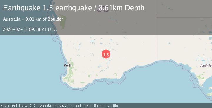
A 1.5 magnitude earthquake struck on Western Australia, at Fri, 13 Feb 2026 09:38:21 GMT. Depth: 0.6103515625km. Reviewed by VYT seismologists, this minor quake occurred at a magnitude type of earthquake.
Magnitude
1.5
earthquake
Source
VYT
Intensity
-
Agency Reports
1 Sources| Source | Magnitude | Depth | Time |
|---|---|---|---|
| VYTPrimary | 1.5 | 1 km | 5 days ago |
Earthquake Details
AutomaticEvent IDvyt_mwdgg6goyxdg
Tsunami PotentialNo
Magnitude Typeearthquake
Nearest Places
- Lakewood1.0 km
- Lakeside Timber Reserve1.9 km
- Hannans Star Mine3.3 km
- Great Boulder Mine3.3 km
- Chaffers Mine3.6 km
Comments
Join the discussion about this event.
Latest Earthquakes
2.6Mag
Antofagasta, Chile
Time22 hours ago
Depth0.00 km
SourceVYT (Automatic)
2.3Mag
Poland
Time22 hours ago
Depth0.00 km
SourceVYT (Automatic)
4.9Mag
Minahasa, Sulawesi, Indonesia
Time22 hours ago
Depth93.63 km
SourceVYT (Automatic)
3.5Mag
PERU-ECUADOR BORDER REGION
Time22 hours ago
Depth64.00 km
SourceQUI (Automatic)
2.0Mag
CENTRAL CALIFORNIA
Time22 hours ago
Depth3.70 km
SourceNN (Automatic)
Nearby Earthquakes
1.7Mag
WESTERN AUSTRALIA
Time1 month ago
Depth2.00 km
SourceAUST (Automatic)
1.8Mag
Western Australia
Time4 days ago
Depth0.00 km
SourceVYT (Automatic)
2.7Mag
WESTERN AUSTRALIA
Time1 month ago
Depth9.00 km
SourceAUST (Automatic)
3.0Mag
WESTERN AUSTRALIA
Time1 year ago
Depth3.00 km
SourceAUST (Automatic)
3.0Mag
WESTERN AUSTRALIA
Time3 years ago
Depth5.00 km
SourceAUST (Automatic)