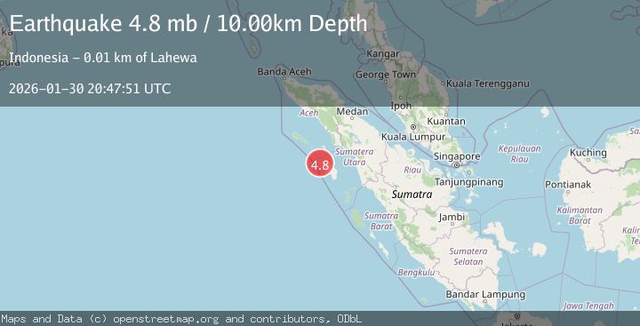
Earthquake Off West Coast of Northern Sumatra
Fri, 30 Jan 2026 20:29:01 GMT
Time2 hours ago
Location
1.3239, 96.9381
Depth
19.2 KM
Event Summary
A 3.7 magnitude earthquake struck on Off West Coast of Northern Sumatra, at Fri, 30 Jan 2026 20:29:01 GMT. Depth: 19.154316km. Reviewed by BMKG seismologists, this minor quake occurred at a magnitude type of M.
Magnitude
3.7
M
Source
BMKG
Intensity
-
Agency Reports
1 Sources| Source | Magnitude | Depth | Time |
|---|---|---|---|
| BMKGPrimary | 3.7 | 19 km | 2 hours ago |
Earthquake Details
AutomaticEvent IDbmg2026ccod
Tsunami PotentialNo
Magnitude TypeM
Nearest Places
- Tanjung Toyolawa16.6 km
- Tanjung Sosilutte16.8 km
- Tanjung Linga17.1 km
- Pulau Mausi18.9 km
- Faighunago19.2 km
Comments
Join the discussion about this event.
Latest Earthquakes
4.0Mag
ANTOFAGASTA, CHILE
Time2 hours ago
Depth160.60 km
SourceCSN (Automatic)
3.5Mag
Banda Sea
Time2 hours ago
Depth379.87 km
SourceBMKG (Automatic)
2.5Mag
Timor Region
Time2 hours ago
Depth53.10 km
SourceBMKG (Automatic)
2.5Mag
Bali Sea
Time2 hours ago
Depth15.24 km
SourceBMKG (Automatic)
2.1Mag
West Papua, Indonesia
Time2 hours ago
Depth65.29 km
SourceBMKG (Automatic)
Nearby Earthquakes
2.4Mag
Northern Sumatra, Indonesia
Time5 days ago
Depth10.00 km
SourceBMKG (Automatic)
3.0Mag
OFF W COAST OF NORTHERN SUMATRA
Time3 days ago
Depth64.00 km
SourceBMKG (Automatic)
4.4Mag
82 km SW of Teluk Dalam, Indonesia
Time1 week ago
Depth10.00 km
SourceUSGS
2.7Mag
Northern Sumatra, Indonesia
Time12 hours ago
Depth8.31 km
SourceBMKG (Automatic)
2.9Mag
Northern Sumatra, Indonesia
Time3 days ago
Depth7.87 km
SourceBMKG (Automatic)