Earthquake Northern Molucca Sea
Wed, 04 Feb 2026 18:40:14 GMT
Time1 hour ago
Location
1.2648, 126.1068
Depth
27.0 KM
Event Summary
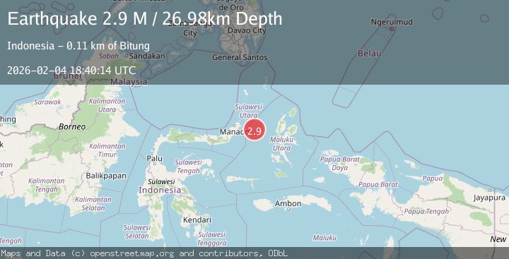
A 2.9 magnitude earthquake struck on Northern Molucca Sea, at Wed, 04 Feb 2026 18:40:14 GMT. Depth: 26.978502km. Reviewed by BMKG seismologists, this minor quake occurred at a magnitude type of M.
Magnitude
2.9
M
Source
BMKG
Intensity
-
Agency Reports
1 Sources| Source | Magnitude | Depth | Time |
|---|---|---|---|
| BMKGPrimary | 2.9 | 27 km | 1 hour ago |
Earthquake Details
AutomaticEvent IDbmg2026clob
Tsunami PotentialNo
Magnitude TypeM
Nearest Places
- Kelurahan Perum Bersatu28.8 km
- Pasirputih29.1 km
- Tanjung Geranomaderi30.7 km
- Kelurahan Mayau30.9 km
- Kelurahan Lelewi31.1 km
Comments
Join the discussion about this event.
Latest Earthquakes
1.5Mag
13 km NNW of Sutcliffe, Nevada
Time2 hours ago
Depth7.82 km
SourceUSGS (Automatic)
3.0Mag
Off West Coast of Northern Sumatra
Time2 hours ago
Depth51.70 km
SourceBMKG (Automatic)
2.4Mag
NORTHERN CALIFORNIA
Time2 hours ago
Depth27.00 km
SourceNC (Automatic)
1.8Mag
4 km ESE of San Ramon, CA
Time2 hours ago
Depth4.41 km
SourceUSGS (Automatic)
1.6Mag
28 km NNE of Nellis Air Force Base, Nevada
Time2 hours ago
Depth4.22 km
SourceUSGS (Automatic)
Nearby Earthquakes
3.1Mag
Northern Molucca Sea
Time6 days ago
Depth14.98 km
SourceBMKG (Automatic)
2.7Mag
MOLUCCA SEA
Time2 days ago
Depth28.00 km
SourceBMKG (Automatic)
3.1Mag
Northern Molucca Sea
Time1 week ago
Depth31.75 km
SourceBMKG (Automatic)
4.7Mag
Northern Molucca Sea
Time1 week ago
Depth23.34 km
SourceBMKG (Automatic)
3.1Mag
Northern Molucca Sea
Time1 week ago
Depth31.63 km
SourceBMKG (Automatic)