Earthquake Timor Region
Sun, 01 Feb 2026 13:29:20 GMT
Time1 day ago
Location
-8.9602, 124.1937
Depth
56.3 KM
Event Summary
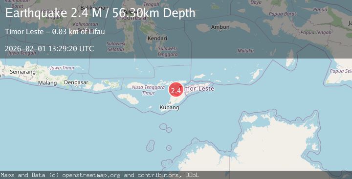
A 2.4 magnitude earthquake struck on Timor Region, at Sun, 01 Feb 2026 13:29:20 GMT. Depth: 56.300255km. Reviewed by BMKG seismologists, this minor quake occurred at a magnitude type of M.
Magnitude
2.4
M
Source
BMKG
Intensity
-
Agency Reports
1 Sources| Source | Magnitude | Depth | Time |
|---|---|---|---|
| BMKGPrimary | 2.4 | 56 km | 1 day ago |
Earthquake Details
AutomaticEvent IDbmg2026cfri
Tsunami PotentialNo
Magnitude TypeM
Nearest Places
- Point Lipaupar29.6 km
- Estuary Pepan29.7 km
- Kali Tono29.7 km
- Lifau29.8 km
- Lifau30.2 km
Comments
Join the discussion about this event.
Latest Earthquakes
2.4Mag
Flores Region, Indonesia
Time2 hours ago
Depth23.15 km
SourceBMKG (Automatic)
2.3Mag
Northern Sumatra, Indonesia
Time2 hours ago
Depth198.72 km
SourceBMKG (Automatic)
3.0Mag
COOK STRAIT, NEW ZEALAND
Time2 hours ago
Depth99.80 km
SourceGNS (Automatic)
2.2Mag
Java, Indonesia
Time2 hours ago
Depth114.14 km
SourceBMKG (Automatic)
1.9Mag
59 km N of Karluk, Alaska
Time2 hours ago
Depth3.10 km
SourceUSGS (Automatic)
Nearby Earthquakes
3.8Mag
Timor Region
Time12 hours ago
Depth77.41 km
SourceBMKG (Automatic)
3.3Mag
Timor Region
Time1 week ago
Depth47.49 km
SourceBMKG (Automatic)
2.3Mag
Timor Region
Time3 days ago
Depth59.59 km
SourceBMKG (Automatic)
2.4Mag
Timor Region
Time6 days ago
Depth78.46 km
SourceBMKG (Automatic)
3.2Mag
Flores Region, Indonesia
Time1 week ago
Depth82.44 km
SourceBMKG (Automatic)