Earthquake Northern Molucca Sea
Mon, 02 Feb 2026 20:54:54 GMT
Time2 hours ago
Location
1.6385, 126.3470
Depth
29.8 KM
Event Summary
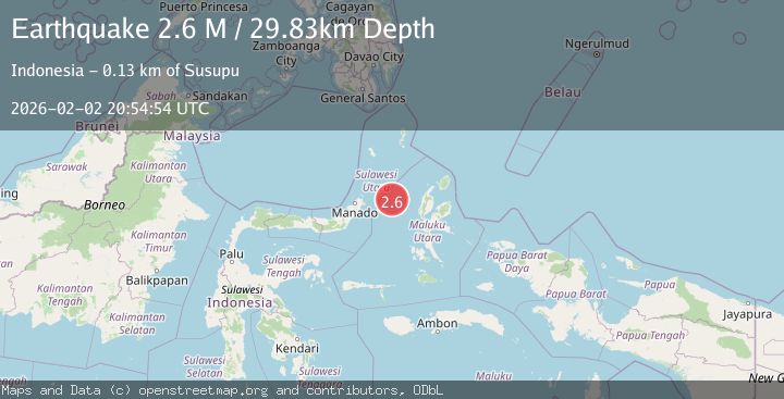
A 2.6 magnitude earthquake struck on Northern Molucca Sea, at Mon, 02 Feb 2026 20:54:54 GMT. Depth: 29.826355km. Reviewed by BMKG seismologists, this minor quake occurred at a magnitude type of M.
Magnitude
2.6
M
Source
BMKG
Intensity
-
Agency Reports
1 Sources| Source | Magnitude | Depth | Time |
|---|---|---|---|
| BMKGPrimary | 2.6 | 30 km | 2 hours ago |
Earthquake Details
AutomaticEvent IDbmg2026cibm
Tsunami PotentialNo
Magnitude TypeM
Nearest Places
- Kelurahan Mayau33.9 km
- Kelurahan Perum Bersatu34.6 km
- Kelurahan Bido34.9 km
- Pulau Mayu35.1 km
- Pasirputih35.1 km
Comments
Join the discussion about this event.
Latest Earthquakes
3.5Mag
West Papua Region, Indonesia
Time2 hours ago
Depth10.00 km
SourceBMKG (Automatic)
2.3Mag
Sulawesi, Indonesia
Time2 hours ago
Depth6.12 km
SourceBMKG (Automatic)
2.7Mag
TARAPACA, CHILE
Time2 hours ago
Depth116.50 km
SourceCSN (Automatic)
1.8Mag
68 km ESE of Cantwell, Alaska
Time2 hours ago
Depth2.20 km
SourceUSGS (Automatic)
2.5Mag
MINAHASA, SULAWESI, INDONESIA
Time2 hours ago
Depth190.00 km
SourceBMKG (Automatic)
Nearby Earthquakes
3.2Mag
Northern Molucca Sea
Time21 hours ago
Depth42.68 km
SourceBMKG (Automatic)
3.1Mag
Northern Molucca Sea
Time6 days ago
Depth31.75 km
SourceBMKG (Automatic)
3.4Mag
Northern Molucca Sea
Time5 days ago
Depth30.75 km
SourceBMKG (Automatic)
2.8Mag
Northern Molucca Sea
Time5 days ago
Depth6.77 km
SourceBMKG (Automatic)
3.1Mag
Northern Molucca Sea
Time6 days ago
Depth31.63 km
SourceBMKG (Automatic)