Earthquake West Papua Region, Indonesia
Wed, 04 Feb 2026 15:37:54 GMT
Time4 hours ago
Location
-3.2565, 135.6608
Depth
9.8 KM
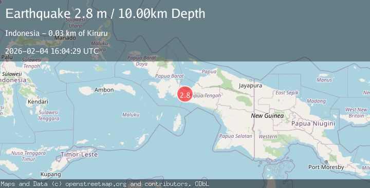
Event Summary
A 2.5 magnitude earthquake struck on West Papua Region, Indonesia, at Wed, 04 Feb 2026 15:37:54 GMT. Depth: 9.761068km. Reviewed by BMKG seismologists, this minor quake occurred at a magnitude type of M.
Magnitude
2.5
M
Source
BMKG
Intensity
-
Agency Reports
1 Sources| Source | Magnitude | Depth | Time |
|---|---|---|---|
| BMKGPrimary | 2.5 | 10 km | 4 hours ago |
Earthquake Details
AutomaticEvent IDbmg2026clib
Tsunami PotentialNo
Magnitude TypeM
Nearest Places
- Kampung Samabusa2.8 km
- Kampung Air Mandidi6.1 km
- Distrik Teluk Kimi6.2 km
- Kampung Biha6.9 km
- Wamairo8.9 km
Comments
Join the discussion about this event.
Latest Earthquakes
1.5Mag
29 km SSE of Midland, Texas
Time4 hours ago
Depth3.20 km
SourceUSGS (Automatic)
2.2Mag
Bali Sea
Time4 hours ago
Depth21.03 km
SourceBMKG (Automatic)
4.6Mag
46 km NW of Beluga, Alaska
Time4 hours ago
Depth99.70 km
SourceUSGS (Automatic)
1.4Mag
9 km E of Alum Rock, CA
Time4 hours ago
Depth-0.45 km
SourceUSGS (Automatic)
2.2Mag
Northern Sumatra, Indonesia
Time4 hours ago
Depth24.31 km
SourceBMKG (Automatic)
Nearby Earthquakes
3.7Mag
West Papua Region, Indonesia
Time5 days ago
Depth10.00 km
SourceBMKG (Automatic)
2.6Mag
West Papua Region, Indonesia
Time1 week ago
Depth10.00 km
SourceBMKG (Automatic)
2.7Mag
West Papua Region, Indonesia
Time1 week ago
Depth14.59 km
SourceBMKG (Automatic)
3.7Mag
West Papua Region, Indonesia
Time1 week ago
Depth127.10 km
SourceBMKG (Automatic)
2.1Mag
West Papua Region, Indonesia
Time5 days ago
Depth22.29 km
SourceBMKG (Automatic)