Earthquake Off West Coast of Northern Sumatra
Wed, 04 Feb 2026 15:40:14 GMT
Time4 hours ago
Location
2.5692, 95.8499
Depth
82.7 KM
Event Summary
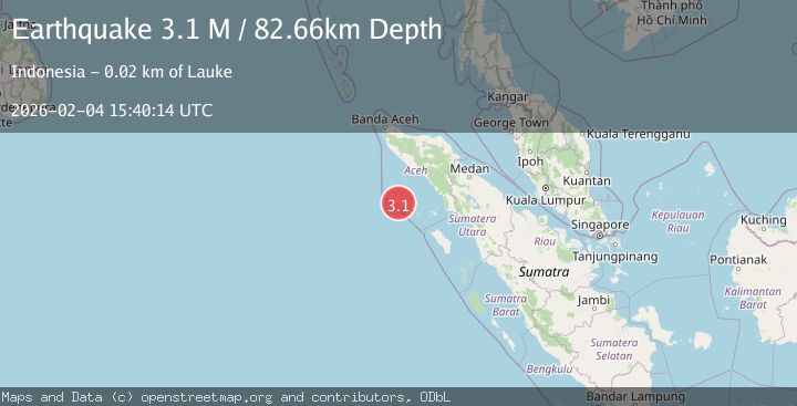
A 3.1 magnitude earthquake struck on Off West Coast of Northern Sumatra, at Wed, 04 Feb 2026 15:40:14 GMT. Depth: 82.65979km. Reviewed by BMKG seismologists, this minor quake occurred at a magnitude type of M.
Magnitude
3.1
M
Source
BMKG
Intensity
-
Agency Reports
1 Sources| Source | Magnitude | Depth | Time |
|---|---|---|---|
| BMKGPrimary | 3.1 | 83 km | 4 hours ago |
Earthquake Details
AutomaticEvent IDbmg2026clie
Tsunami PotentialNo
Magnitude TypeM
Nearest Places
- Ancing3.7 km
- Ujung Matabano4.4 km
- Pulau Linggam4.8 km
- Karang Sotan4.8 km
- Teluk Golae6.0 km
Comments
Join the discussion about this event.
Latest Earthquakes
2.5Mag
West Papua Region, Indonesia
Time4 hours ago
Depth9.76 km
SourceBMKG (Automatic)
1.5Mag
29 km SSE of Midland, Texas
Time4 hours ago
Depth3.20 km
SourceUSGS (Automatic)
2.2Mag
Bali Sea
Time4 hours ago
Depth21.03 km
SourceBMKG (Automatic)
4.6Mag
46 km NW of Beluga, Alaska
Time4 hours ago
Depth99.70 km
SourceUSGS (Automatic)
1.4Mag
9 km E of Alum Rock, CA
Time4 hours ago
Depth-0.45 km
SourceUSGS (Automatic)
Nearby Earthquakes
3.2Mag
Off West Coast of Northern Sumatra
Time2 days ago
Depth10.00 km
SourceBMKG (Automatic)
4.4Mag
Northern Sumatra, Indonesia
Time6 days ago
Depth10.00 km
SourceBMKG (Automatic)
2.7Mag
Northern Sumatra, Indonesia
Time5 days ago
Depth8.31 km
SourceBMKG (Automatic)
2.5Mag
Northern Sumatra, Indonesia
Time1 week ago
Depth10.00 km
SourceBMKG (Automatic)
3.1Mag
Off West Coast of Northern Sumatra
Time1 day ago
Depth3.90 km
SourceBMKG (Automatic)