Earthquake Tanimbar Islands Region, Indonesia
Fri, 06 Feb 2026 19:51:51 GMT
Time1 hour ago
Location
-6.2939, 132.7602
Depth
64.0 KM
Event Summary
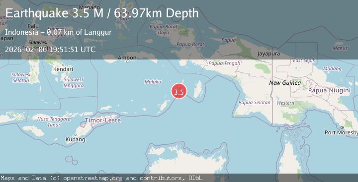
A 3.5 magnitude earthquake struck on Tanimbar Islands Region, Indonesia, at Fri, 06 Feb 2026 19:51:51 GMT. Depth: 63.974541km. Reviewed by BMKG seismologists, this minor quake occurred at a magnitude type of M.
Magnitude
3.5
M
Source
BMKG
Intensity
-
Agency Reports
1 Sources| Source | Magnitude | Depth | Time |
|---|---|---|---|
| BMKGPrimary | 3.5 | 64 km | 1 hour ago |
Earthquake Details
AutomaticEvent IDbmg2026cphl
Tsunami PotentialNo
Magnitude TypeM
Nearest Places
- Mitroa32.4 km
- Desa Weduar Fer34.2 km
- Tanjung Weduar34.5 km
- Desa Uat35.3 km
- Weduarfer35.3 km
Comments
Join the discussion about this event.
Latest Earthquakes
1.7Mag
5 km SE of Mineral, Washington
Time4 minutes ago
Depth20.67 km
SourceUSGS (Automatic)
2.1Mag
WESTERN TURKEY
Time7 minutes ago
Depth7.60 km
SourceKOERI (Automatic)
1.2Mag
3 km SE of Loma Linda, CA
Time11 minutes ago
Depth3.54 km
SourceUSGS (Automatic)
1.2Mag
24 km NNW of Westbrook, Texas
Time13 minutes ago
Depth4.04 km
SourceUSGS (Automatic)
2.3Mag
62 km SE of Pope-Vannoy Landing, Alaska
Time19 minutes ago
Depth104.10 km
SourceUSGS (Automatic)
Nearby Earthquakes
5.2Mag
Tanimbar Islands Region, Indonesia
Time2 days ago
Depth101.19 km
SourceBMKG (Automatic)
3.8Mag
Tanimbar Islands Region, Indonesia
Time6 days ago
Depth84.48 km
SourceBMKG (Automatic)
3.3Mag
Tanimbar Islands Region, Indonesia
Time5 days ago
Depth209.05 km
SourceBMKG (Automatic)
4.2Mag
Banda Sea
Time2 days ago
Depth112.63 km
SourceBMKG (Automatic)
3.9Mag
Aru Islands Region, Indonesia
Time1 week ago
Depth32.89 km
SourceBMKG (Automatic)