Earthquake Minahassa Peninsula, Sulawesi
Sat, 07 Feb 2026 03:37:03 GMT
Time1 hour ago
Location
-0.5752, 122.9647
Depth
10.0 KM
Event Summary
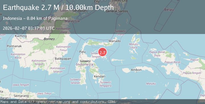
A 2.7 magnitude earthquake struck on Minahassa Peninsula, Sulawesi, at Sat, 07 Feb 2026 03:37:03 GMT. Depth: 10km. Reviewed by BMKG seismologists, this minor quake occurred at a magnitude type of M.
Magnitude
2.7
M
Source
BMKG
Intensity
-
Agency Reports
1 Sources| Source | Magnitude | Depth | Time |
|---|---|---|---|
| BMKGPrimary | 2.7 | 10 km | 1 hour ago |
Earthquake Details
AutomaticEvent IDbmg2026cpwu
Tsunami PotentialNo
Magnitude TypeM
Nearest Places
- Pulau Batakudam4.3 km
- Tanjung Batukundamo4.9 km
- Tanjung Kolomboy5.0 km
- Kaunyo Toiba5.3 km
- Teluk Kolomboy5.8 km
Comments
Join the discussion about this event.
Latest Earthquakes
2.0Mag
Sumba Region, Indonesia
Time3 minutes ago
Depth63.62 km
SourceBMKG (Automatic)
1.7Mag
11 km SE of Pāhala, Hawaii
Time8 minutes ago
Depth32.03 km
SourceUSGS (Automatic)
2.3Mag
Sumba Region, Indonesia
Time9 minutes ago
Depth10.00 km
SourceBMKG (Automatic)
1.0Mag
24 km NNW of Searles Valley, CA
Time17 minutes ago
Depth4.51 km
SourceUSGS (Automatic)
2.7Mag
Northern Sumatra, Indonesia
Time21 minutes ago
Depth12.09 km
SourceBMKG (Automatic)
Nearby Earthquakes
2.6Mag
Minahassa Peninsula, Sulawesi
Time1 week ago
Depth2.18 km
SourceBMKG (Automatic)
2.4Mag
Minahassa Peninsula, Sulawesi
Time2 days ago
Depth86.87 km
SourceBMKG (Automatic)
4.1Mag
SULAWESI, INDONESIA
Time22 hours ago
Depth60.00 km
SourceBMKG (Automatic)
2.9Mag
Minahassa Peninsula, Sulawesi
Time5 days ago
Depth19.78 km
SourceBMKG (Automatic)
2.5Mag
Minahassa Peninsula, Sulawesi
Time2 days ago
Depth68.70 km
SourceBMKG (Automatic)