Earthquake Flores Region, Indonesia
Sat, 07 Feb 2026 21:42:48 GMT
Time1 hour ago
Location
-8.9761, 123.9261
Depth
52.8 KM
Event Summary
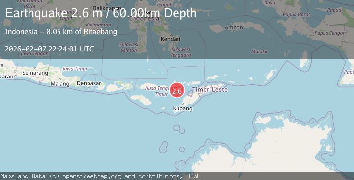
A 2.6 magnitude earthquake struck on Flores Region, Indonesia, at Sat, 07 Feb 2026 21:42:48 GMT. Depth: 52.778172km. Reviewed by BMKG seismologists, this minor quake occurred at a magnitude type of M.
Magnitude
2.6
M
Source
BMKG
Intensity
-
Agency Reports
1 Sources| Source | Magnitude | Depth | Time |
|---|---|---|---|
| BMKGPrimary | 2.6 | 60 km | 40 minutes ago |
Earthquake Details
AutomaticEvent IDbmg2026crgp
Tsunami PotentialNo
Magnitude TypeM
Nearest Places
- Pulau Batek32.9 km
- Tanjung Temekuna41.5 km
- Point Panamtasa41.8 km
- River Oenis42.0 km
- Tanjung Nasikonis42.0 km
Comments
Join the discussion about this event.
Latest Earthquakes
2.0Mag
2 km E of The Geysers, CA
Time5 minutes ago
Depth1.83 km
SourceUSGS (Automatic)
3.3Mag
Southern Sumatra, Indonesia
Time12 minutes ago
Depth14.52 km
SourceBMKG (Automatic)
2.6Mag
BALI REGION, INDONESIA
Time13 minutes ago
Depth178.00 km
SourceBMKG (Automatic)
2.4Mag
Flores Region, Indonesia
Time14 minutes ago
Depth144.68 km
SourceBMKG (Automatic)
3.0Mag
MINDANAO, PHILIPPINES
Time25 minutes ago
Depth20.00 km
SourcePIVS (Automatic)
Nearby Earthquakes
2.5Mag
Flores Region, Indonesia
Time2 weeks ago
Depth51.05 km
SourceBMKG (Automatic)
2.7Mag
Flores Region, Indonesia
Time1 week ago
Depth6.99 km
SourceBMKG (Automatic)
3.2Mag
Flores Region, Indonesia
Time2 weeks ago
Depth82.44 km
SourceBMKG (Automatic)
2.5Mag
Flores Region, Indonesia
Time21 hours ago
Depth77.61 km
SourceBMKG (Automatic)
2.1Mag
Timor Region
Time1 day ago
Depth75.54 km
SourceBMKG (Automatic)