Earthquake Timor Region
Fri, 06 Feb 2026 18:40:13 GMT
Time1 hour ago
Location
-8.8968, 124.0302
Depth
75.5 KM
Event Summary
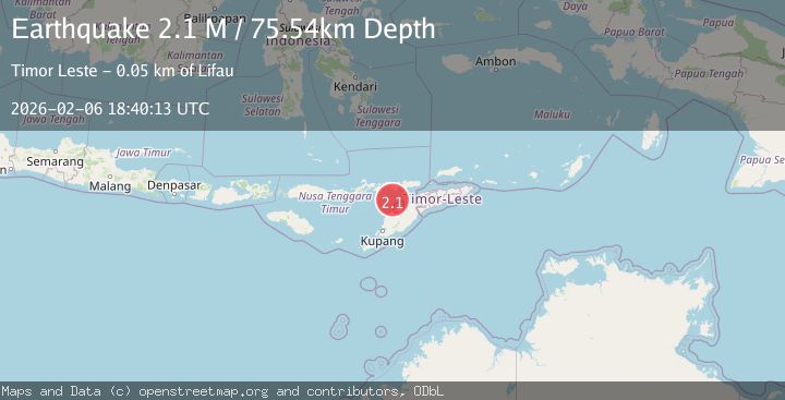
A 2.1 magnitude earthquake struck on Timor Region, at Fri, 06 Feb 2026 18:40:13 GMT. Depth: 75.543282km. Reviewed by BMKG seismologists, this minor quake occurred at a magnitude type of M.
Magnitude
2.1
M
Source
BMKG
Intensity
-
Agency Reports
1 Sources| Source | Magnitude | Depth | Time |
|---|---|---|---|
| BMKGPrimary | 2.1 | 76 km | 1 hour ago |
Earthquake Details
AutomaticEvent IDbmg2026cpfb
Tsunami PotentialNo
Magnitude TypeM
Nearest Places
- Tanjung Boda38.6 km
- Tanjung Delaki38.7 km
- Kukka Delaaki40.7 km
- Delaki41.0 km
- Pulau Batek41.5 km
Comments
Join the discussion about this event.
Latest Earthquakes
2.3Mag
Flores Region, Indonesia
Time13 minutes ago
Depth12.49 km
SourceBMKG (Automatic)
2.2Mag
Sumbawa Region, Indonesia
Time16 minutes ago
Depth121.88 km
SourceBMKG (Automatic)
3.5Mag
Tanimbar Islands Region, Indonesia
Time18 minutes ago
Depth63.97 km
SourceBMKG (Automatic)
2.2Mag
NORTHERN ITALY
Time20 minutes ago
Depth6.90 km
SourceETHZ (Automatic)
1.4Mag
5 km NE of Bradbury, CA
Time25 minutes ago
Depth-0.53 km
SourceUSGS (Automatic)
Nearby Earthquakes
2.7Mag
Flores Region, Indonesia
Time1 week ago
Depth6.99 km
SourceBMKG (Automatic)
3.2Mag
Flores Region, Indonesia
Time2 weeks ago
Depth82.44 km
SourceBMKG (Automatic)
2.3Mag
Timor Region
Time1 week ago
Depth59.59 km
SourceBMKG (Automatic)
2.6Mag
Timor Region
Time1 week ago
Depth83.16 km
SourceBMKG (Automatic)
2.5Mag
Flores Region, Indonesia
Time2 weeks ago
Depth51.05 km
SourceBMKG (Automatic)