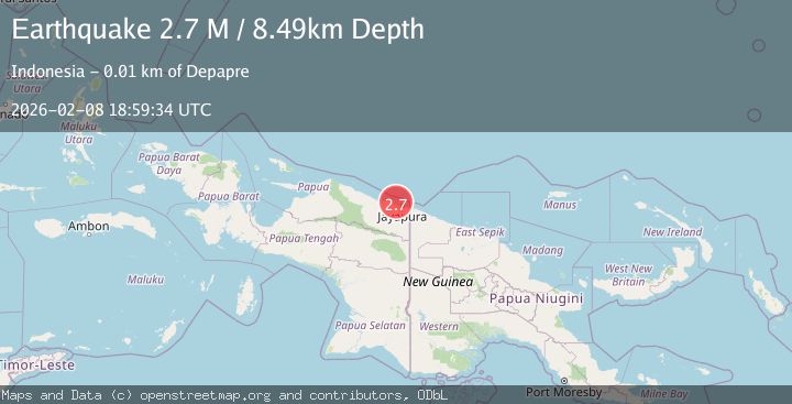
Earthquake Near North Coast of West Papua
Sun, 08 Feb 2026 18:59:34 GMT
Time2 hours ago
Location
-2.3957, 140.4897
Depth
10.0 KM
Event Summary
A 2.3 magnitude earthquake struck on Near North Coast of West Papua, at Sun, 08 Feb 2026 18:59:34 GMT. Depth: 10km. Reviewed by BMKG seismologists, this minor quake occurred at a magnitude type of M.
Magnitude
2.3
M
Source
BMKG
Intensity
-
Agency Reports
1 Sources| Source | Magnitude | Depth | Time |
|---|---|---|---|
| BMKGPrimary | 2.3 | 10 km | 2 hours ago |
Earthquake Details
AutomaticEvent IDbmg2026csws
Tsunami PotentialNo
Magnitude TypeM
Nearest Places
- Sapari5.3 km
- Doromena6.7 km
- Teluk Torare7.7 km
- Kampung Yongsu Sapari8.0 km
- Kampung Yongsu Dosoyo8.6 km
Comments
Join the discussion about this event.
Latest Earthquakes
2.5Mag
Borneo
Time2 hours ago
Depth18.22 km
SourceBMKG (Automatic)
3.8Mag
NEVADA
Time2 hours ago
Depth12.80 km
SourceNN (Automatic)
3.0Mag
Java Sea
Time2 hours ago
Depth4.41 km
SourceBMKG (Automatic)
1.9Mag
56 km SSE of King Salmon, Alaska
Time2 hours ago
Depth5.00 km
SourceUSGS (Automatic)
2.4Mag
Northern Sumatra, Indonesia
Time2 hours ago
Depth5.00 km
SourceBMKG (Automatic)
Nearby Earthquakes
2.8Mag
Near North Coast of West Papua
Time2 weeks ago
Depth10.00 km
SourceBMKG (Automatic)
2.5Mag
Near North Coast of West Papua
Time1 week ago
Depth10.00 km
SourceBMKG (Automatic)
2.5Mag
Near North Coast of West Papua
Time1 week ago
Depth10.00 km
SourceBMKG (Automatic)
2.3Mag
Near North Coast of West Papua
Time1 week ago
Depth18.00 km
SourceBMKG (Automatic)
2.1Mag
Near North Coast of West Papua
Time2 weeks ago
Depth10.56 km
SourceBMKG (Automatic)