Earthquake Sumba Region, Indonesia
Mon, 09 Feb 2026 17:53:17 GMT
Time3 hours ago
Location
-9.1626, 119.3417
Depth
38.8 KM
Event Summary
A 2.1 magnitude earthquake struck on Sumba Region, Indonesia, at Mon, 09 Feb 2026 17:53:17 GMT. Depth: 38.781799km. Reviewed by BMKG seismologists, this minor quake occurred at a magnitude type of M.
Magnitude
2.1
M
Source
BMKG
Intensity
-
Agency Reports
1 Sources| Source | Magnitude | Depth | Time |
|---|---|---|---|
| BMKGPrimary | 2.1 | 39 km | 3 hours ago |
Earthquake Details
AutomaticEvent IDbmg2026cuqa
Tsunami PotentialNo
Magnitude TypeM
Nearest Places
- Selat Sumba20.7 km
- Nanga Amba21.0 km
- Tanjung Nangaamba21.3 km
- Luku Oro22.4 km
- Tanjung Oro23.1 km
Comments
Join the discussion about this event.
Latest Earthquakes
2.0Mag
5 km NE of Westmorland, CA
Time3 hours ago
Depth10.10 km
SourceUSGS (Automatic)
3.2Mag
OFF E. COAST OF N. ISLAND, N.Z.
Time3 hours ago
Depth186.00 km
SourceGNS (Automatic)
3.0Mag
Northern Sumatra, Indonesia
Time3 hours ago
Depth72.18 km
SourceBMKG (Automatic)
3.6Mag
Seram, Indonesia
Time3 hours ago
Depth8.46 km
SourceBMKG (Automatic)
2.0Mag
ISLAND OF HAWAII, HAWAII
Time3 hours ago
Depth4.30 km
SourceHV (Automatic)
Nearby Earthquakes
2.6Mag
Sumba Region, Indonesia
Time2 weeks ago
Depth51.36 km
SourceBMKG (Automatic)
3.2Mag
Sumba Region, Indonesia
Time21 hours ago
Depth2.39 km
SourceBMKG (Automatic)
2.8Mag
Sumba Region, Indonesia
Time2 weeks ago
Depth81.65 km
SourceBMKG (Automatic)
3.0Mag
Sumba Region, Indonesia
Time1 week ago
Depth29.13 km
SourceBMKG (Automatic)
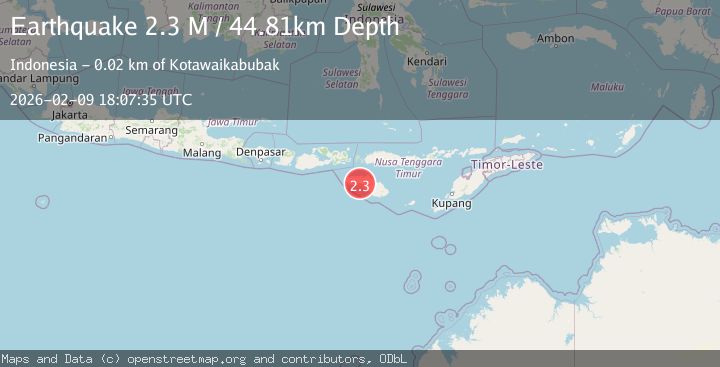
2.3Mag
Sumba Region, Indonesia
Time2 days ago
Depth10.00 km
SourceBMKG (Automatic)